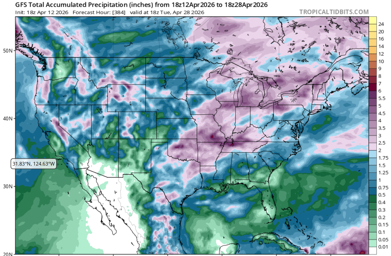
The latest 7-day QPF map shows conditions that will be as dry as a bone for the next week for the vast majority of the Southeast. Just a few areas show any rain at all and only western Tennessee has a chance of getting anything really substantial. What is worse is that if you look at the longer-range maps, there is essentially no rain in the forecast until April 23 or later, with most of it coming around April 28. That is a long time for farmers to wait for moisture for their crops. I am sure irrigation is going full on where available, but diesel is expensive so farmers will want to use water judiciously and not water more than needed. You can find smart irrigation apps developed at UGA at https://smartirrigationapps.org/.
I included the GFS long-range map for the latest model run to show what rain is expected for the entire 384 hour run (through April 28). Keep in mind that almost all the rain that is shown in the area of D4 exceptional drought in southern GA and northern Florida will see no rain until about the 27th, according to the model. Of course, things will likely change before then, but at the moment the situation looks pretty dire, especially with temperatures in the next week expected to approach 90 F in some locations, near-record early in many areas. You can run this model at https://www.tropicaltidbits.com/analysis/models/?model=gfs®ion=us&pkg=apcpn and run it forward over time to see how the rain chances evolve.

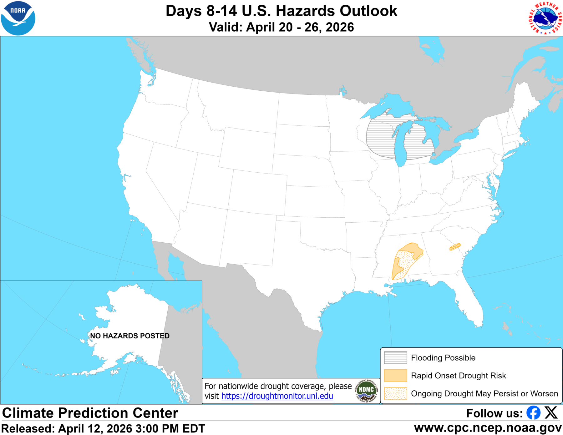
Because of the extreme heat and dryness, drought is likely to continue to expand across the region over the next few weeks. The 8-14 day map below shows that areas in Alabama and Georgia that are not currently in drought are likely to see it show up there in a couple of weeks.