-
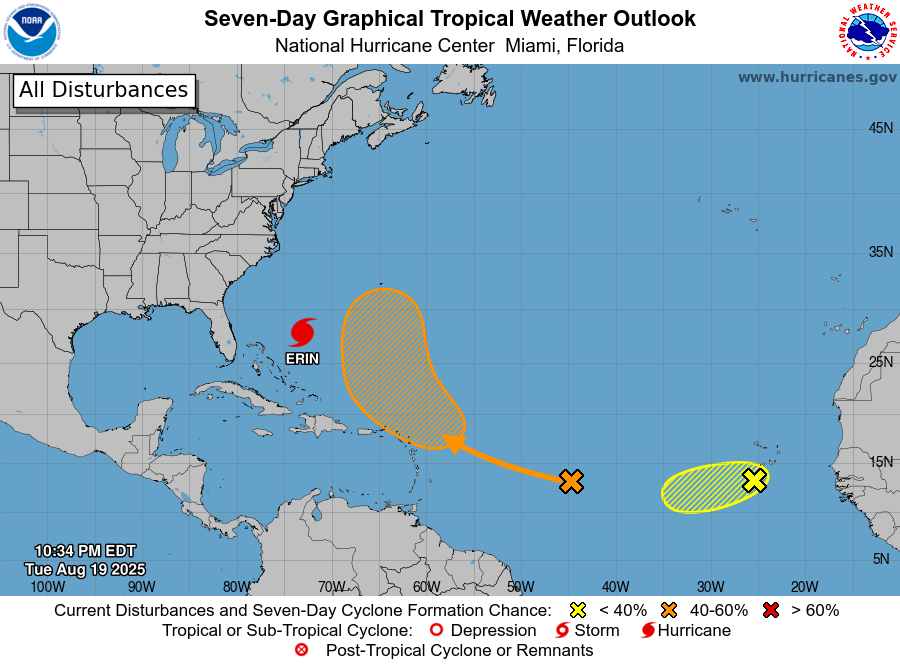
The latest 7-day tropical outlook shows that Erin is still on course to turn north and then northeast, passing between the US East Coast and Bermuda. But the track has been shifting a little to the west, which means that the Outer Banks of NC could see more wind and rain than previously predicted even…
Posted in: Uncategorized -
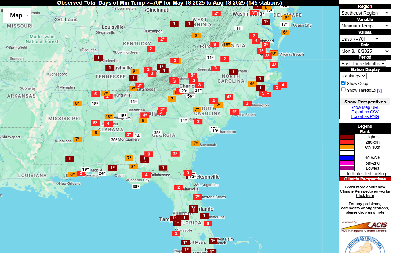
One indication of how hot and humid it has been for most of the summer this year is the number of nights that have never gotten below 70 F. For many stations, this 3-month period has been consistently well above normal in minimum temperatures due to a combination of rising temperatures globally and the increased…
Posted in: Climate summaries -

According to a new study described in Science News this week, the increasing temperatures in fall could be changing the way monarch butterflies prepare for their migration down to Mexico and disturbing their usual pause in reproduction that allows them to survive the long flight south. Warmer temperatures appear to be making the butterflies go…
-

While Hurricane Erin is not directly affecting the Southeast, the East Coast is being hit by high waves and heavy surf generated by Erin’s winds. This is leading to dangerous rip currents along the coast that have led to many rescues along Carolina beaches already, far ahead of the storm’s strongest effects. NOAA has a…
Posted in: Uncategorized -
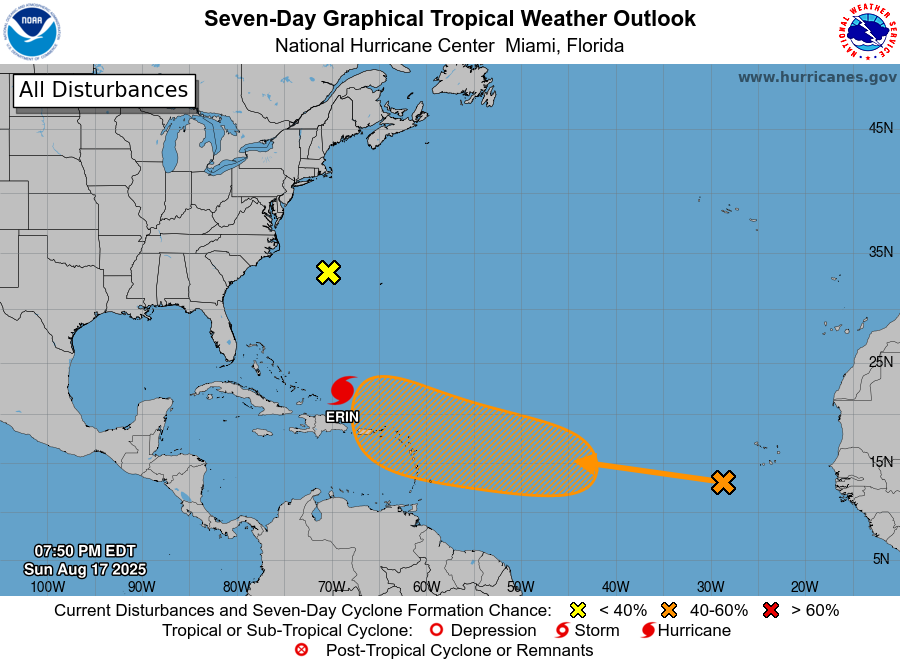
It’s that time of year. The tropics are becoming more active and every wave coming off of Africa has to be watched for signs of development. Today we are watching Major Hurricane Erin as it moves NW on a path that is expected to curve north and then NE off the East Coast between Bermuda…
Posted in: Tropical weather -
The Weather Channel posted an interesting short video about the life cycle of a hurricane to explain how hurricanes develop from tropical waves and grow into full-fledged strong storms. Very timely considering how we have watched Erin grow from a weak wave to a category 5 storm in just a few days. Erin is now…
-

The rainfall on this week’s 7-day QPF map is dominated by rainfall from Hurricane Erin as it moves north past the East Coast. It won’t be close enough to cause much rain on the mainland, but if you are at the beach you will see very high surf and a chance of rip currents, so…
Posted in: Climate outlooks