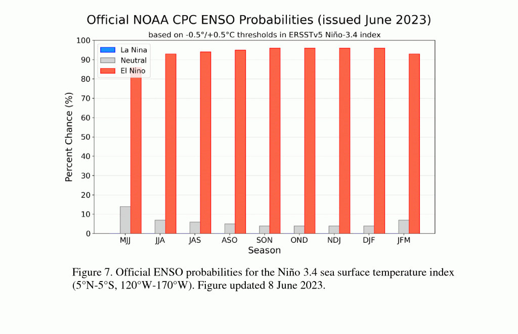
Today NOAA’s Climate Prediction Center announced that El Niño is here and is expected to get stronger over the next few months. It is expected to last into at least spring 2024, which is as far ahead as the predictions show in their graphics. The ocean temperatures have been in place for a while already, but NOAA was waiting to see the atmosphere respond to those conditions before the official determination was made. You can read more at https://www.weather.gov/news/230706-ElNino.
If you are interested in looking at how El Niño affects temperature and precipitation, you can look at statistical summaries by 3-month period at https://www.cpc.ncep.noaa.gov/products/precip/CWlink/ENSO/composites/EC_ENP_index.shtml. The anomalies show the expected departure from the normal climate and the frequency shows how often in the past these have occurred, which gives you a sense of the likelihood of this outcome. They show both El Niño-related departures and the long-term trend towards warmer temperatures, so the combination tells us how the combination of warming conditions and an El Niño are likely to affect us for the next few seasons.
The summary is that we are unlikely to see a drought this summer and fall, although fall could be drier than normal due to fewer tropical storms in the Atlantic. But if winter El Niño conditions come on early this year as some climatologists expect, we could see a wet late fall as well. The climate next winter is likely to be cooler and wetter than normal, with cloudy conditions associated with the storm track keeping daytime temperatures cooler than expected, although overnight lows may not be extremely cold since cloud cover will keep temperatures from dropping as much as clear skies.
