-

One of the amazing things about this summer (to me) has been the unrelenting nature of the heat this year. We’ve had very few days over 100 F and most days were nowhere near a record temperature for the date, but the number of runs of days above thresholds like 90 F for max temperatures…
-
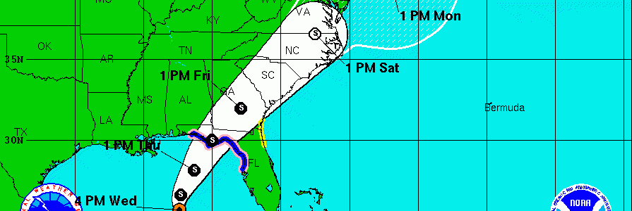
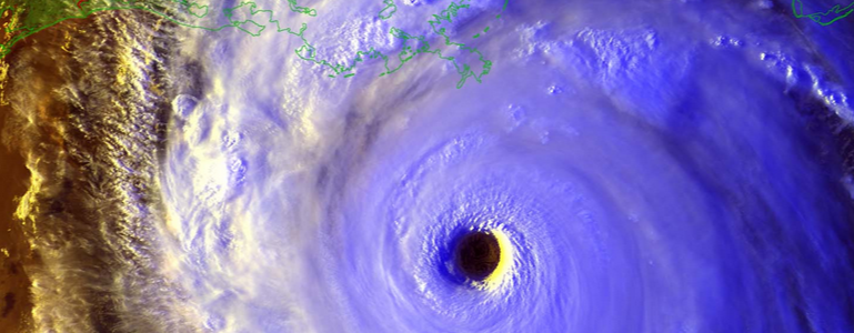
The 5 pm forecast from the National Hurricane Center shows a significant shift of the forecast cone to the west from earlier in the day. It puts the center of the track just southeast of Macon at 1 pm on Friday. The cone itself covers the southeastern 2/3 of Georgia, so anyone driving through that…
Posted in: Tropical weather -
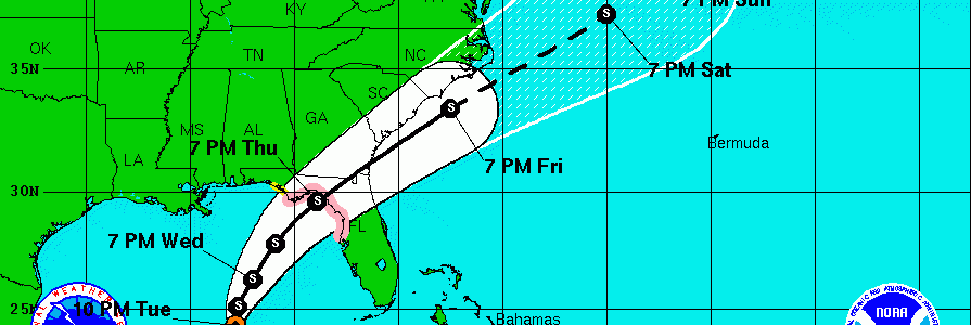
The latest update from the National Hurricane Center on Tropical Depression 9 shows that with its slow movement and development, it has not yet begun to move towards the northeast. This means that the updated most likely path has now moved north and west of its position earlier today. Most of the southeastern half of…
Posted in: Tropical weather -
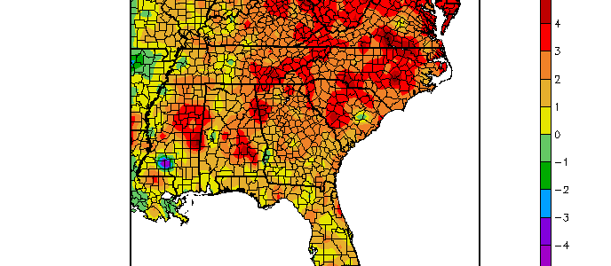
August is almost over, and a look at the temperature departures for the Southeast help explain why drought has been expanding across central and southern Georgia. Most of northern Georgia has been fairly close to normal in precipitation, but the southern half of Georgia and particularly along the coast has been quite dry. Combined with the…
-
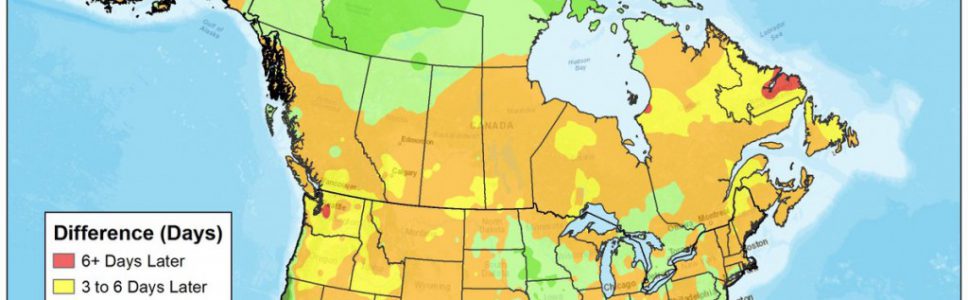
The Weather Channel posted an interesting map earlier this month showing how the date of the peak heat in the summer has changed over time. Parts of the US are peaking later in the summer, but in most of the Southeast, the average date of the highest temperature is actually coming several days earlier now…
-

The 11 pm outlook for Tropical Depression 9 shows a consistent pattern with earlier forecasts. The low is expected to become a Tropical Storm sometime tomorrow and should eventually move northeast over the northern Florida panhandle. The forecast cone has narrowed considerably with a better developed center and more consistency between computer models. The storm is…
Posted in: Tropical weather -
Eleven years ago, Hurricane Katrina made landfall on the Gulf Coast. One of the hardest hit areas was the Mississippi Coast, where Stennis Air Force Base is located. Many NOAA personnel were located there and suffered severe personal losses from the direct hit. Last year they put together a story site which contains information about…