-
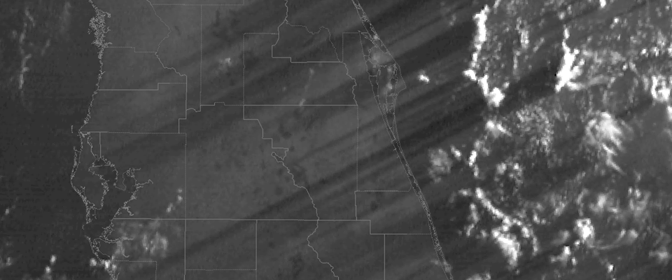
Jordan McLeod of the Southeast Regional Climate Center shared this spectacular photo from NWS Melbourne’s Facebook page showing GOES-16’s imagery of long shadows cast by thunderstorms off Florida’s east coast just after sunrise. Amazing! Here’s the text that went with it: Offshore showers and storms cast long shadows across the entire Florida peninsula just after…
Posted in: Interesting weather images -

In NOAA’s monthly weather briefing on Thursday, they provided a special section discussing the forecast for high tides and coastal flooding for the US in 2017 following record high flood events in 2016. Here are a couple of slides I captured from the briefing. They show that two areas in the Southeast set all-time records…
-
A recent study by NASA scientists shows that climatologists may be underestimating the amount of rain that might fall in the future because of underestimates in the loss of high-level clouds in the tropics. You might think that less clouds means less rain, not more, but because these high clouds can change the energy balance…
-

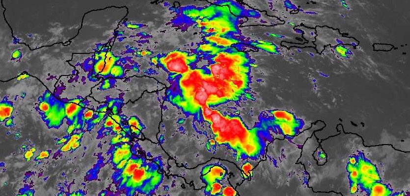
The latest 7-day QPF map shows that moderate rainfall should affect the Southeast in the coming week. Rain could fall any day but the largest amounts are expected to remain off the coast, while inland areas should receive an inch to 1.5 inches for most of the region.
Posted in: Climate outlooks -
EarthSky had an interesting post this morning about why sunsets take longer when you are near a solstice, as we are (the summer solstice is coming up next week). You might be interested in reading more about it. You can see the article here.
Posted in: Climate science -
As I mentioned earlier this week, the Atlantic Ocean’s tropical season is starting to kick in, and there are two areas which may become named storms in the next few days. You can read more about it at Weather Underground here. No immediate threat for us in the US, but they will bear watching for…
-

Here’s an interesting article from Fivethirtyeight.com about why NOAA and USDA have slightly different plant hardiness zone maps. These maps help gardeners determine what kind of plants are likely to do well in a given location and are based primarily on lowest minimum temperatures. Because of the way they are calculated, the two maps show…