-
The Southeast Regional Climate Center’s latest monthly climate summary for March 2019 is now available. You can access it at https://www.sercc.com/SoutheastRegionMonthlyClimateReportMarch2019.pdf.
Posted in: Climate summaries -
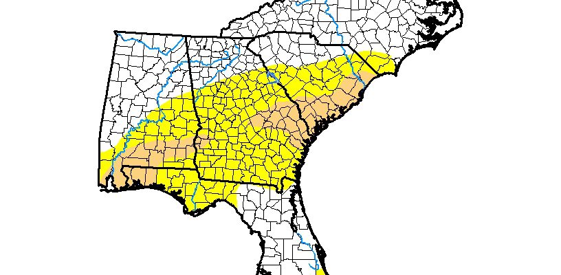
The latest Drought Monitor, released this morning, shows that the areas of abnormally dry conditions (D0) and moderate drought (D1) expanded again this week. They now cover the southeastern third of Alabama, the western Florida panhandle, most of the southern half of Georgia, and parts of coastal South and North Carolina as well as a…
Posted in: Drought -
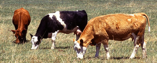
IFAS posted a story last week which discussed the increase in weeds that are likely coming to pastures this years. The wet conditions may encourage some weeds, and the increase in sunlight due to the large number of downed trees will stimulate the growth of many more. You can read more about the problems that…
-
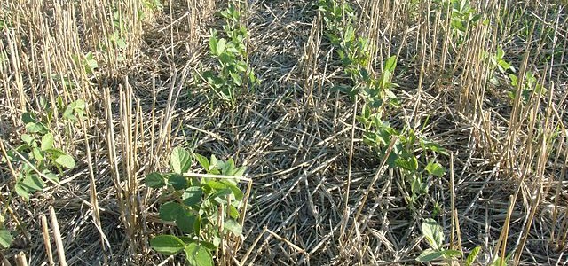
With all of the rain that has fallen in many parts of the US, it is no surprise that farmers are having to rethink their plans for planting. The wet conditions have delayed farmers’ access to their fields, and in some areas they may have to wait quite a bit longer before they can get…
Posted in: Coastal -
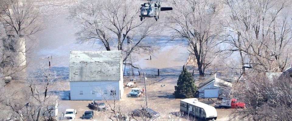
While it’s a clear and sunny day here in the Southeast, farmers in the Midwest are still struggling with the impacts of the catastrophic flooding that hit in March. Some of them may never return to farming after seeing their herds, barns and houses washed away and their fields buried under feet of river silt…
-

I can’t tell you how many times I have heard the comment that “meteorologists are the only people who get paid for making bad forecasts”. In fact, most meteorologists are pretty good at making weather forecasts, so good, in fact, that you probably don’t even notice their skill. It’s the few tough forecasts that they…
Posted in: Climate and Ag in the news -
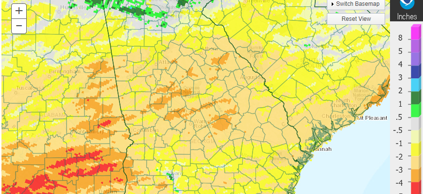
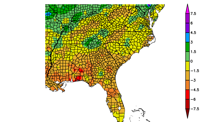
March 2019 was near normal in temperature across the state, but almost all areas received much less than the normally expected rainfall, leading to an expansion in abnormally dry conditions in the southern half of the state as well as the introduction of some moderate drought in the southeast. A widespread severe weather outbreak on…
Posted in: Climate summaries