-

I use the Midwestern Regional Climate Center’s website every week to obtain climate information for data requests I get or studies I am working on. This week the MRCC moved from Champaign IL to Purdue IN. It now has a new website at https://mrcc.purdue.edu. To use their CLI-MATE software, you do need to create a…
Posted in: Sources of weather and climate data -

According to an article this week in the Southeast Farm Press, this year’s weather in North Carolina has been almost perfect for growers. The corn crop is particularly good due to weather conditions early in the summer. The cotton is doing well but still needs some moisture before it is mature. Peanuts are also doing…
-

Today Hurricane Ida made landfall in Louisiana around noon local time with winds of 150 mph, a storm surge up to 16 feet by at least one report, and torrential rains that could bring up to 20 inches of rain to the area. The winds, surge, and rain brought widespread damage to the area, with…
-
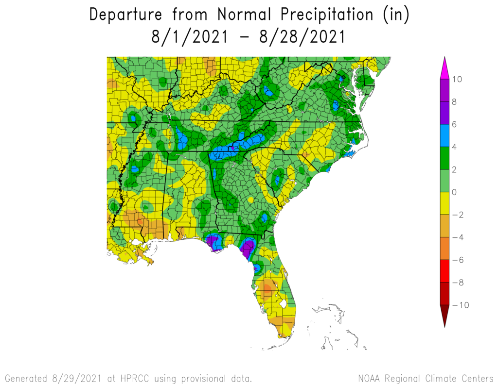
It’s almost the end of August 2021, so let’s take a quick look at the month to date. The maps from the High Plains Regional Climate Center show that most of the region was warmer than normal this month, with the lowest departures from normal in Alabama and Georgia. The next few days should be…
Posted in: Climate summaries -
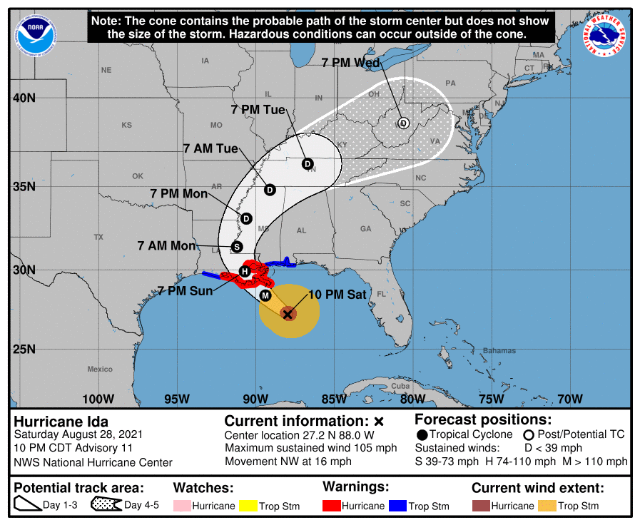
As of 11 pm, Hurricane Ida has winds of 105 mph and is continuing to head to the coast of Louisiana, where it is expected to make landfall as a major hurricane near New Orleans. The forecasts have been nudging slightly east, but it’s not clear if that will continue or not. Any changes to…
Posted in: Tropical weather -
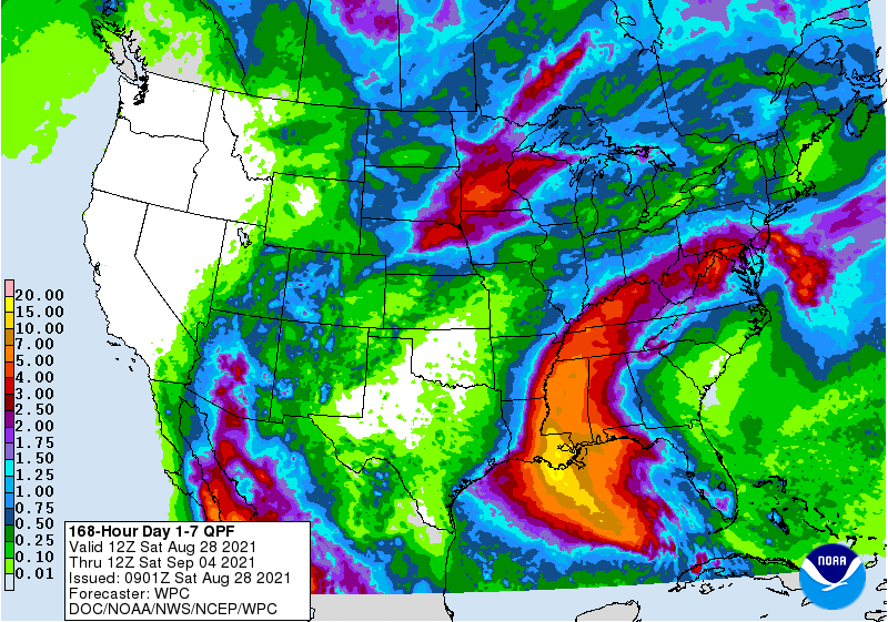
Hurricane Ida is currently strengthening in the Gulf of Mexico. It is expected to come onshore in Louisiana on Sunday or Monday as a major hurricane and will cause catastrophic damage to eastern LA with winds of up to 140 mph and storm surge up to 11 feet in some locations. It will also bring…
Posted in: Climate outlooks -

Today Ida was upgraded to a hurricane. With exceptionally warm water in the Gulf of Mexico, there is a high potential that the storm may reach a category 4 major hurricane before it makes landfall in Louisiana west of New Orleans. That will put NOLA in the right front quadrant of the storm as it…