Tropical weather
-
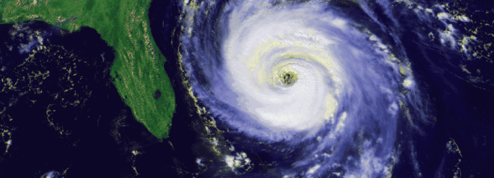
The tropics are starting to heat up with the development of Tropical Depression 6, which is expected to become TS Fiona within a few days. It won’t hit the Southeast in all probability, but the next storm might come a lot closer. Here are two web sites with helpful information on preparing for a tropical…
-
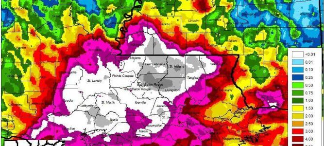
It seems that the national media is finally becoming aware of the unfolding tragedy that is the flooding occurring in Louisiana. There have been many more reports on the flooding in the last couple of days. So far, 9 people have been killed and over 20,000 displaced by the flooding. According to the Wunder Blog,…
-

NOAA released their updated Atlantic hurricane season forecast for 2016 yesterday. NOAA calls for a higher likelihood of a near-normal or above-normal season, and decreases the chance of a below-normal season to only 15 percent, from the initial outlook issued in May. You can read it at https://www.noaa.gov/media-release/atlantic-hurricane-season-still-expected-to-be-strongest-since-2012.
-

The Capital Weather Gang has a thoughtful article today describing the current drought of major hurricanes hitting the US and why it is so worrisome. The streak has reached 3,939 days, two years longer than any previous drought. The drought for Florida is more than ten years, and for Georgia much longer than that. The…
-

William Schmitz of the Southeast Regional Climate Center pointed out a great source of historical hurricane track information to me today. You can find it at https://weather.unisys.com/hurricane/index.php. This provides the best known tracks to hurricanes going back to 1851. (The map below is for 1893 just because it has a lot of tracks on it.) Obviously,…
-

The National Hurricane Center has just announced that they will begin issuing advisories on Tropical Storm Earl, currently located in the western Caribbean Sea and moving west towards Mexico. It is not expected to affect the Southeast or the rest of the US. You can get more information at https://www.nhc.noaa.gov or at https://www.spaghettimodels.com.
-

The water temperature in the Atlantic Ocean is nice and warm, well above the long-term average. But in spite of the warm water, the tropics have been very slow to start producing any tropical storms this year after an early start to the season. In part this is due to the presence of Saharan dust…