Tropical weather
-
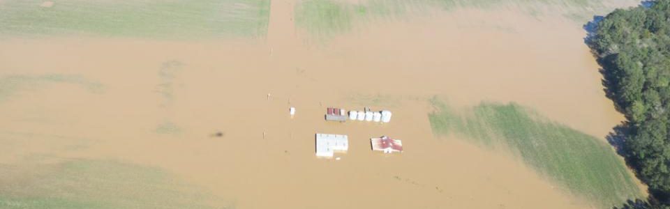
As I write this, heavy rains associated with an upper level low moving up the East Coast are battering parts of eastern North Carolina. Many of these same communities were devastated by Hurricane Matthew in its trek along the Atlantic Coast last fall. That is why it was so sad to read this article in…
-
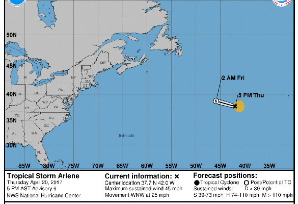
Even though the Atlantic tropical season does not begin until June 1, this year we have the early formation of Tropical Storm Arlene way out in the central Atlantic Ocean. It is far from land and not expected to affect anything except shipping routes. You can read more about it at USA Today here…
Posted in: Tropical weather -
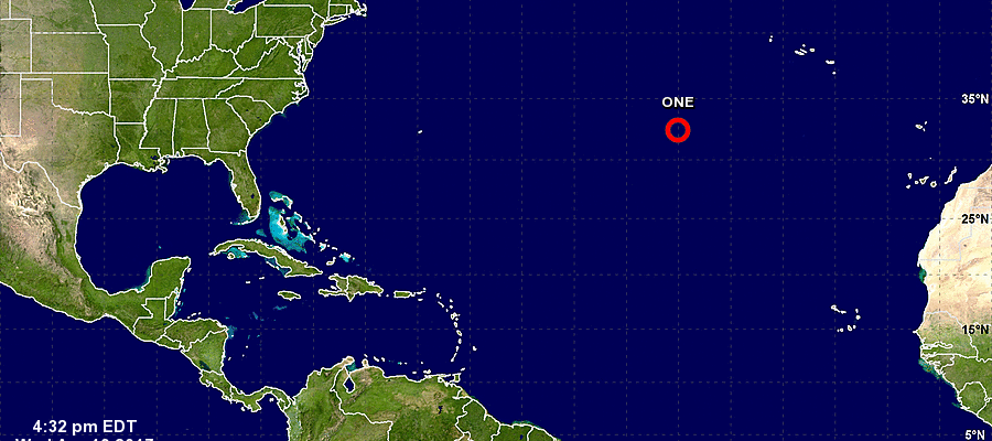
The Atlantic tropical season is off to an early start this year with the development of Subtropical Depression 1 well out in the Atlantic Ocean. A subtropical storm has some characteristics of tropical storms and some that make it look more like a mid-latitude cyclone. The official start of the tropical season is June, but…
Posted in: Tropical weather -
From the Florida Climate Center: ‘This article outlines the perspectives of Palm Beach County residents who evacuated their homes and also those who chose not to during Hurricane Matthew. It is an interesting read. However, as always, we strongly encourage you to heed all evacuation orders.” You can read the article from the Palm Beach…
-
The first forecast for the Atlantic hurricane season for 2017 is now out. Colorado State University issued their forecast today and it shows that they are expecting a slightly below normal hurricane season in the Atlantic Ocean basin. This is due to the current neutral ENSO conditions, which are expected to transition into an El…
-
NOAA announced yesterday that the official report from the National Hurricane Center on Hurricane Matthew is now available. Matthew caused 34 direct deaths in the Southeast along with several indirect deaths following the storm’s passage. Of those, 25 deaths were in North Carolina. The highest rainfall amount of the storm in the US was 18.95…
-
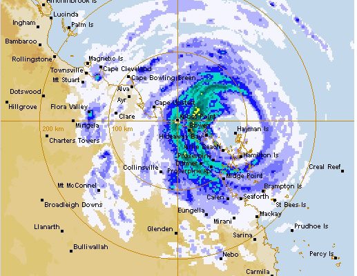
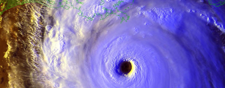
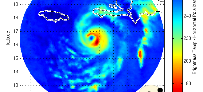
As I write this, Hurricane Debbie is hitting the northeast coast of Australia. While it’s not the strongest hurricane to hit the country, it is still packing a punch. Newser has a story with links to other feeds about the storm as it comes onshore. One of the biggest impacts is expected to be the…