Sources of weather and climate data
-
Have you ever heard the term “degree days?” Heating and cooling degree days are derived from temperature data and used to monitor the amount of energy that is needed for heating and cooling. So if you have a winter like this past one, with a much lower number of heating degree days than average, you…
-
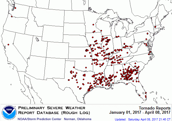
According to the USDA’s Water and Climate Update for April 6, “The number of tornadoes touching down across the U.S. are at a near record pace for 2017. The NWS records starting in 2005 report the number of tornadoes are the second highest as of April 5. 486 tornadoes have touched down thus far, with…
-

NOAA put out a very useful primer on how to use climate data on their blog this week. It describes how climate data are used and where to get what you need. If you need climate data in your work or your kids need it for school, you can check out their instructions at https://www.climate.gov/maps-data/primer/climate-data-primer. You…
Posted in: Sources of weather and climate data -
One of my Facebook groups just put together a list of science books that can serve as resources for parents and teachers, and maybe 4-H agents and others interested in reading more about science. It is divided by age group and science subject and includes quite a few resources on earth science. Not too much…
-

The US Climate Resiliency Toolkit online has a good web page describing some of the steps that farmers currently use to assess their weather and climate vulnerability and how they take measures to protect against risks to their operations. It includes a five-step process to become more resilient in the face of unknown changes to…
-

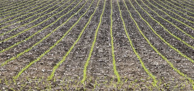
The combination of warmer than usual weather, lack of precipitation and the early emergence of plants from winter dormancy has helped lead to near-record low stream flows for this time of year on many rivers in Georgia. Here are a couple of examples. The Chattahoochee near Cornelia is at record low flows for this time…
-

The South Central Climate Science Center has a series of short videos which cover a variety of aspects of climate science and climate change information. Most of the videos are around 5-7 minutes long and provide information on topics like the carbon cycle, how we measure past climates, and how climate models work, but they…