Interesting weather images
-
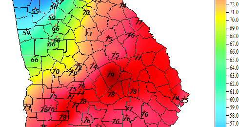
Here is the 4 pm temperature map from the Georgia Automated Environmental Monitoring Network: And here is the surface analysis at the same time: Can you find the front on the temperature map? Cold fronts mark the boundary between warm air in place and the cold air that is advancing into the warm air. In…
-
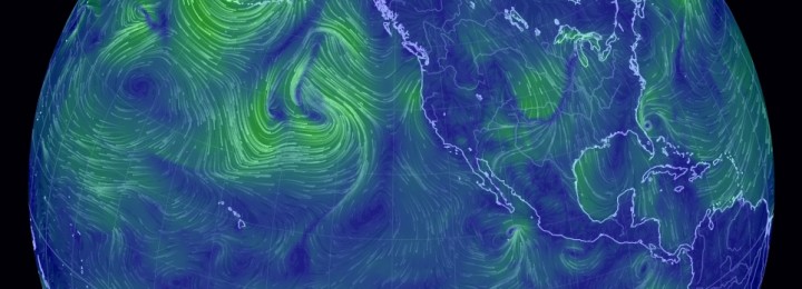
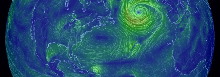
The wind map tonight shows several features that will likely affect our weather in the next few days. The remnants of Typhoon Nuri are still spinning in the Bering Sea and are contributing to the strong wave pattern in the atmosphere. The strong flow of Arctic air into the central Plains can also be seen.…
-
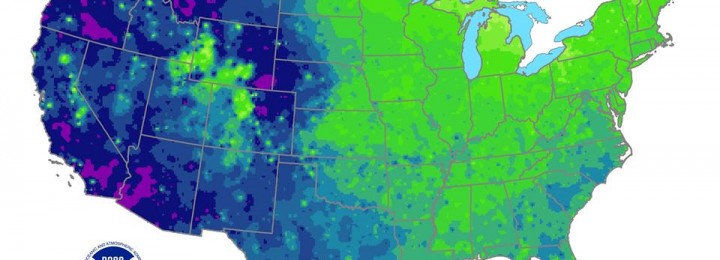
Since cold weather is on the way this coming week, it seems appropriate that NOAA published a map showing the average coldest day of the year. For most of the coastal plains area of the Southeast, the coldest air comes around the first week of January. Areas in the northern part of Georgia and Alabama…
-
Last night parts of the Southeast experienced their first snowfalls of the year. A few areas in Georgia received over an inch, such as Fannin County, and many people sent in photos to the National Weather Service showing the snow that fell at their locations. Some areas in South Carolina received over 6 inches of…
-
Even though the storm system hitting the eastern US today is pretty strong, it pales in comparison to the massive low pressure center south of Iceland in the northeast Atlantic Ocean today. For a great picture of the streamlines of wind across the North Atlantic, go to https://earth.nullschool.net/#current/wind/surface/level/orthographic=-56.44,38.74,563 and watch the wind in motion. I’ve…
-

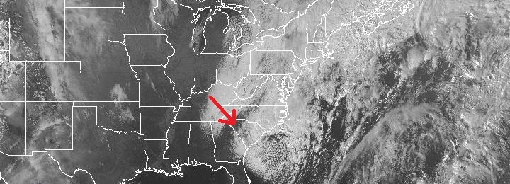
This surface temperature map and weather analysis shows the changes that are coming to the Southeast as the next cold front passes. On this map from Chris Robbin’s Facebook page, you can see the cold air behind the advancing cold front, which is just to the west of Mississippi. The remains of the cold…
Posted in: Interesting weather images -
NASA sends out a picture of the day on email every day. and today was a beautiful one. Seeing the fall colors from space makes fall feel more real. Here is the caption that goes with the image below: A few days after autumn showed up on the calendar in the Northern Hemisphere, it showed…
Posted in: Interesting weather images