Climate science
-

NASA provides a lot of spectacular images from space, but also does a lot of research on changes in the earth’s surface due to human activity as well as changes in climate on different time scales. Here are a couple of examples I ran across this week. Vox.com posted a story based on NASA’s Earth…
Posted in: Climate science -
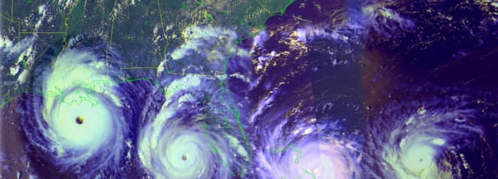
Weather Underground‘s latest blog lists ten myths about hurricanes that are not true. Since the tropical season has already started, it’s important to know about the storms that could affect us here in the Southeast (and beyond!) this summer. You can read the list at https://www.wunderground.com/news/hurricane-myths-debunked-2016#prclt-FiGV1ecp.
-
Spring is officially over (climatologically speaking) and now we look forward to summer. I often get asked whether a hot spring means a hot summer, or some other permutation of that question. Often, there is no correlation between seasons. However, in the latest “Beyond the Data” blog entry from Climate.gov, Deke Arndt discusses the impact of a…
-
Memorial Day weekend marks the beginning of summer for most people, and the folks at NEEF (National Environmental Education Foundation) have put together a couple of articles describing the impact of summer weather conditions on human health. The first article describes the impact of extreme heat on human health and lists some of the symptoms…
-

Don Paul is a recently retired television meteorologist from Buffalo, NY, who is starting a series of articles on weather, climate and related sciences. His first article is on humidity in the atmosphere and dewpoint temperature. You can find it at the Buffalo News here.
Posted in: Climate science -

The Climate Learning Network recently hosted an hour-long webinar by Dr. Marshall Shepherd of UGA on the basics of climate change science. It is now available on demand for viewing at https://www.climatewebinars.net/webinars/climate-change-science-101-for-land-grant-university-administrators/?searchterm=shepherd. I haven’t watched it yet myself, but Dr. Shepherd is usually an engaging speaker who brings in a lot of current information at an…
-

Another climate story related to the Arctic this week is the record-setting low extent of the sea ice in the Arctic Ocean for this time of year. Bob Henson of WunderBlog explains what has been observed this year and what it means for this summer here. The abnormally low snow cover which contributed to warm…