Climate outlooks
-
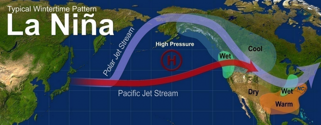
The North Carolina Climate Office posted their winter outlook earlier this week. It is no surprise that it reflects what we know about the current La Nina. While the signal of La Nina is not as strong in North Carolina as it is in northern Florida and Alabama and Georgia, this year’s strong event should…
-
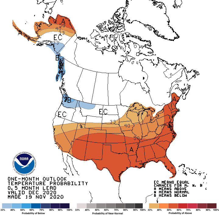
The latest monthly outlook for December 2020 is now out from NOAA’s Climate Prediction Center. It shows that all of the Southeast is expected to be warmer than normal and that most of the region is also likely to be drier than normal. This is consistent with our expectation of the continuing strong La Nina…
Posted in: Climate outlooks -

Unless you live in Florida, you are not likely to much if any rain this week. There is a small chance on Sunday as a weak cold front moves through the area, but by Tuesday a big high pressure dome will park over us, leading to nothing but blue skies and sunshine. Cooler air could…
Posted in: Climate outlooks -

The latest global climate summary for October 2020 is now available from NOAA. It shows that for the earth as a whole, it was the 4th warmest October since records began in 1880. Only 2015, 2019 and 2018 were warmer. You can view the graphics and read the highlights at https://www.noaa.gov/news/remarkably-warm-october-fuels-march-toward-2nd-hottest-year and the full report…
Posted in: Climate outlooks -

If you missed the monthly Climate Outlook for the Southeast from earlier this week, you can now view the recording at https://www.youtube.com/watch?v=Wfdmto1EvSk.
-

Over the last few hours, Eta has weakened from a minimal hurricane to a tropical storm and has lost a lot of its convection as it is approaching Florida. The forward speed of the storm is also faster than originally predicted, which means that impacts at any one spot will last a shorter time than…
-
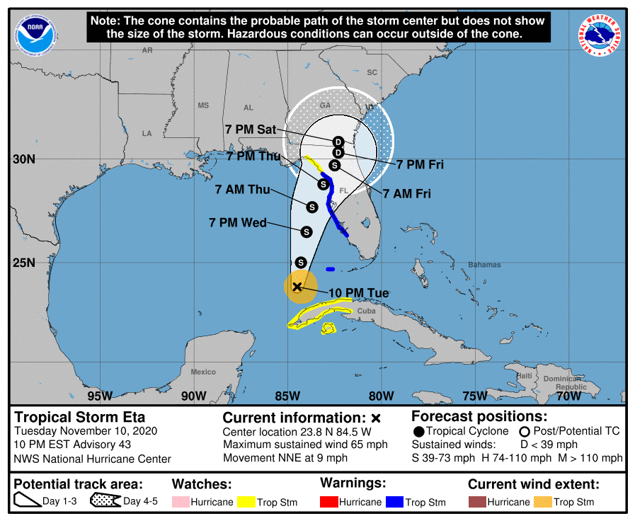
Tropical Storm Eta is currently located just off the northwest corner of Cuba and is expected to make its way slowly north over the rest of this week. The current forecast shows that it is likely to make landfall somewhere between Apalachicola and Tampa, FL on Thursday night into Friday morning. Tropical storm force winds…