Climate outlooks
-
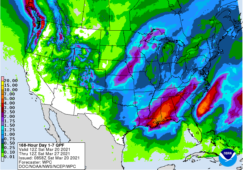
This weekend we will see a coastal storm off the East Coast bring rain inland to areas along that region, although the heaviest rain will remain offshore. By mid-week, a new storm will form near the Gulf of Mexico and bring heavy rain to parts of Alabama and far western Florida. That storm will progress…
Posted in: Climate outlooks -
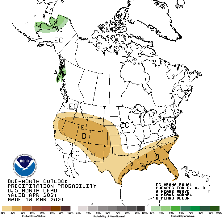
NOAA’s Climate Prediction Center issued its April and April-June outlooks today for 2021. They show that for April, warmer and drier conditions than usual are expected, while for the April through June period, warmer than normal conditions are expected but there is no clear signal for precipitation for most of the region, leading to a…
Posted in: Climate outlooks -

Here is a long (45 minutes) and detailed video made available by AgWeb on YouTube. The talk was given by Eric Snodgrass of Nutrien Ag Solutions at the 2021 Top Producer Summit in mid-February, so some of the current information is a little old, but it’s a great overview of last year’s growing season and…
-
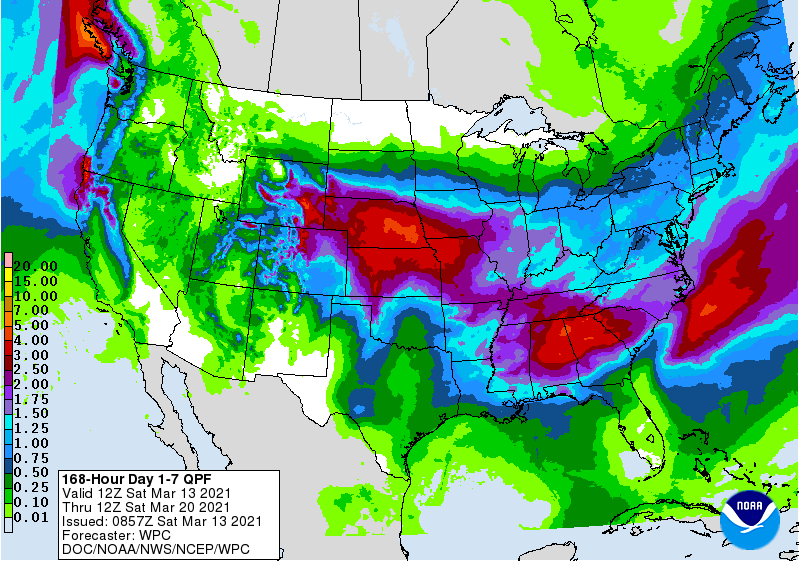
Two quick-moving storms will bring several inches of rain to northern parts of the Southeast this week, while southern areas are mostly dry. The first storm, which is bringing heavy snow to the Denver area this weekend, will push into the Southeast by Tuesday morning, bringing our first batch of rain. A trailing front across…
Posted in: Climate outlooks -
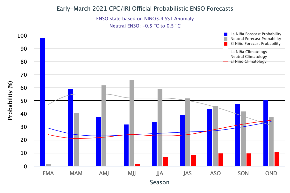
The latest ENSO outlook was released today. It shows that La Nina is still hanging on now, but that neutral conditions are expected to return later this spring and last through summer. The current forecast for next fall and winter is for La Nina to return in a “double dip”, which happens fairly frequently with…
-

Southeast Climate Monthly Webinar + Spring Flood Outlook Tuesday, March 9, 2021 at 10 am ET/9 am CT Join us for the Southeast Climate Monthly Webinar! These webinars provide the region’s stakeholders and interested parties with timely information on current and developing climate conditions such as drought, floods, and tropical storms, as well as climatic…
-
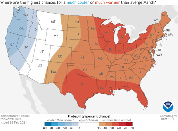
I don’t think I have posted the outlook for March yet. Here is an article from Climate.gov that explains their March 2021 outlook. For the eastern half of the country including the Southeast, temperatures are more likely to be above normal, while precipitation will be more variable, with Florida expected to be drier than normal…
Posted in: Climate outlooks