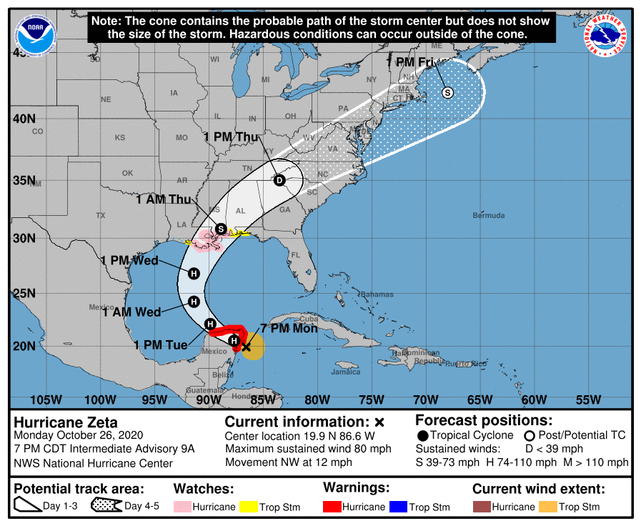
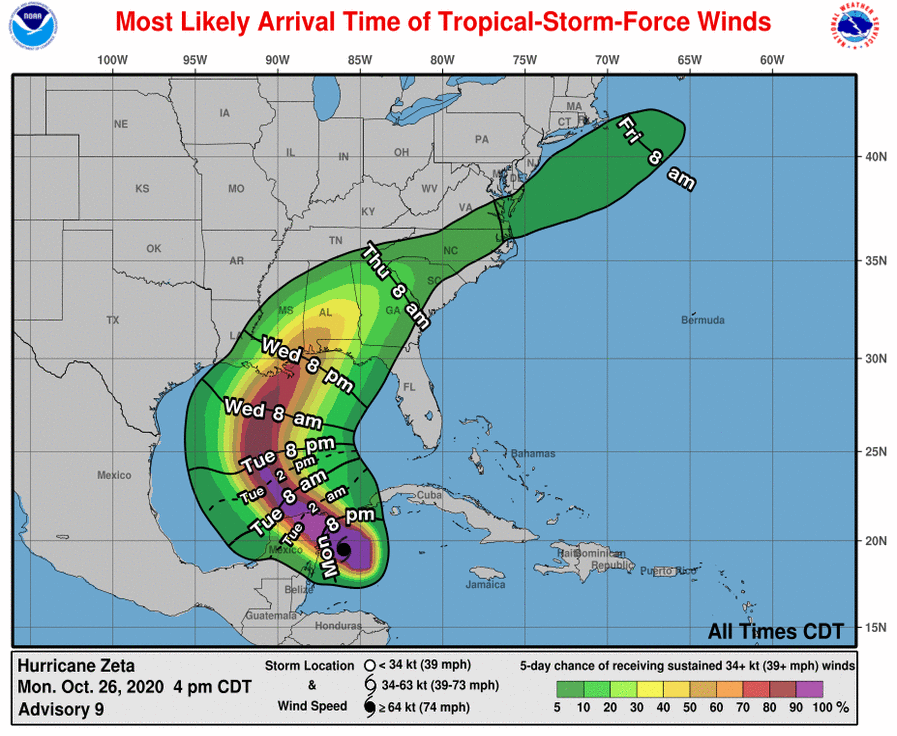
Hurricane Zeta formed today and is headed towards the Yucatan peninsula, where it is expected to make landfall south of Cancun before moving NE into the Gulf of Mexico. It will move north and then northeast as it approaches the northern Gulf Coast on Wednesday afternoon. It is not clear if it will be a hurricane or a tropical storm by the time it makes landfall late Wednesday evening, probably near midnight, but it will contain plenty of strong and gusty winds and heavy rain. It is currently forecast to move northeast over Alabama and northern Georgia on Wednesday night through Thursday before accelerating through the western Carolinas and Virginia Thursday afternoon and evening as a tropical storm.
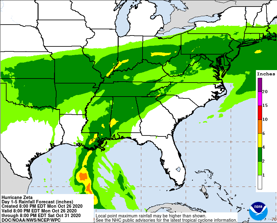
As we have seen with previous storms this year, that puts parts of the Southeast in the right front quadrant of the storm, where we can expect gusty winds, periods of heavy rain, and some isolated severe weather in the rain bands. There is a potential for rain already on Tuesday if a Predecessor Rain Event (PRE) forms ahead of the storm. I will discuss this in a separate blog post. Currently the heaviest rain is expected to be along and to the right of the path of the storm, so if the forecast track shifts, so will the area of strongest winds and heaviest rain. By late on Thursday most of the bad weather will have cleared AL and GA and will be moving out of the Carolinas and Virginia.