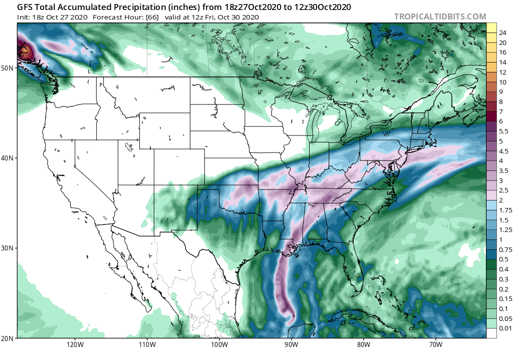
Zeta weakened today as it passed over the Yucatan, but it is expected to strengthen back to hurricane force before making landfall somewhere between New Orleans and Mobile sometime on Wednesday afternoon or evening. After landfall it will accelerate to the northeast–by the time it is over northern GA it will be moving at 30 mph. This rapid speed will help keep rainfall amounts down but will add to the wind gusts, especially on the right side of the storm’s path.
The heaviest rain will be along and just to the right of the storm track through Alabama and northern Georgia, but a lot of the region other than Florida and the East Coast could see at least a half- inch. The rain should be gone by Thursday night. With saturated soils and trees that still have most of their leaves (for now), you can expect to see downed trees and power outages along the path. I expect a lot of leaves will blow away in the storm, so enjoy those fall colors while you can. After Zeta moves out, we should go back under a ridge of high pressure that will keep precipitation very low for the next week. The coldest temperatures will occur Monday morning, and the Southern Appalachians could see some frost before things warm up again.