Climate outlooks
-
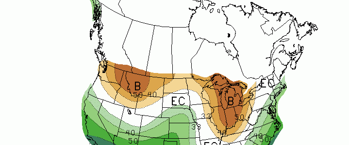
The latest outlook maps from the Climate Prediction Center were released today. They are shown below. They continue to show patterns that are associated with a moderate to strong El Niño signal. The most likely place for cool and wet conditions is the Florida panhandle, with less certainty the farther north you go. However, unusually…
-
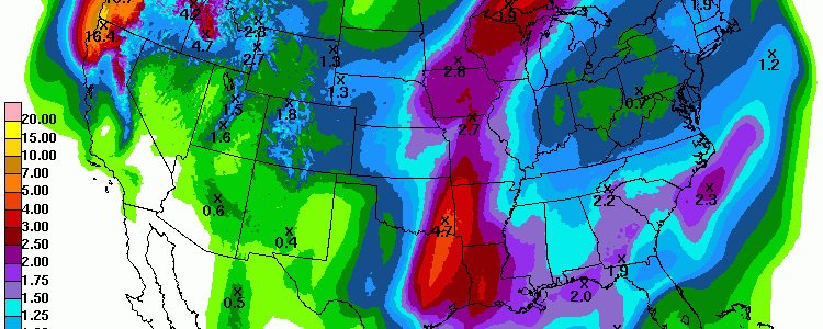
This weekend should be dry for most of the Southeast, but rain returns with a strong front on Sunday night into Monday, and rain will continue for most of the week. The 7-day QPF shows that most of the Southeast will receive an inch or more. Only the southern half of the Florida peninsula will…
Posted in: Climate outlooks -
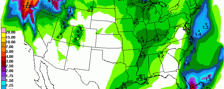
The latest 7-day QPF shows that little rain is expected for the Southeast in the next week. The only exception is very far southern Florida and the area right along the East Coast. By comparison, look at the Pacific Northwest, where amounts of more than 20 inches are expected in some locations. Where would you…
Posted in: Climate outlooks -

The latest climate outlook from NOAA’s Climate Prediction Center is out and shows that for the Southeast, December looks like it has a good chance to continue to be wetter and warmer than normal. Most long-range models show that we are not likely to feel the impacts of Arctic air anytime soon, although a change…
Posted in: Climate outlooks -
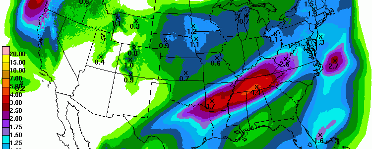
The nearly stationary front that has plagued Texas and the central US this weekend is slowly starting to move off to the east. The Southeast should continue to have dry conditions through the weekend, with wet weather gradually returning to the region starting with the northwest corner on Monday evening. By Wednesday the front will…
-
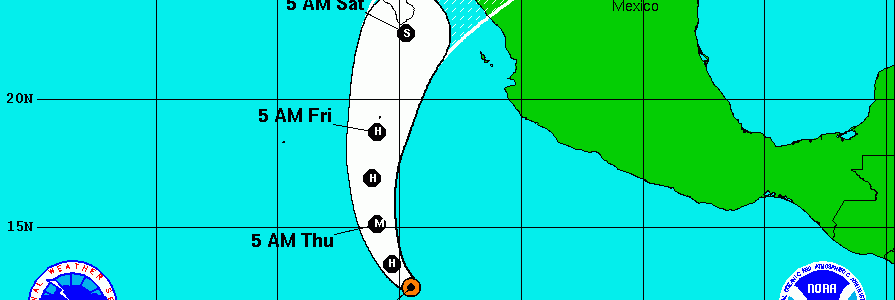
The latest storm in the Eastern Pacific, Hurricane Sandra, could bring another plume of moisture to the south central US later this week. If the storm moves as expected, the moisture will feed into a front in the area and could lead to more wet conditions and potential flooding due to saturated soils that already present…
-

The State Climate Office of North Carolina has released their official forecast for the winter of 2015-16. You can read it on their blog at https://climate.ncsu.edu/climateblog?id=166&h=5666e5c1. Here’s their summary of what to expect for North Carolina this winter. The more general aspects of the forecast are also applicable to the rest of the Southeast, although snowfall…