Pam Knox
-
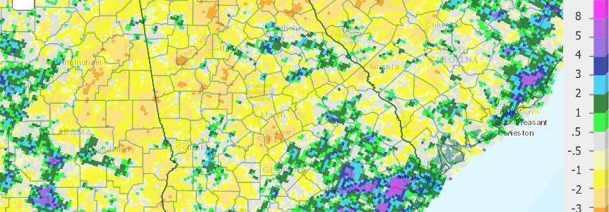
Georgia was well above normal in temperature in June, ranging from one to almost four degrees above the 1981-2010 average. The hottest areas were in the northern part of the state. Rainfall was less than normal in many areas, causing an expansion of drought over the month and the introduction of extreme drought to two…
Posted in: Climate summaries -

190 years ago today, at a little after Noon, Thomas Jefferson died at Monticello, as Americans celebrated the 50th anniversary of the Declaration of Independence. Later that evening, during a Boston summer thunderstorm, John Adams said his last words and died. They were “Jefferson survives”. He was wrong, because he outlived him by ten hours.…
Posted in: History -

It’s time to celebrate America’s 240th year of independence! Hope you have a restful and refreshing day with family and friends.
Posted in: Events -

Fortune magazine posted an interesting article late in June on the complicated relationship between farmers and their acceptance of climate change. Fortune points out that farmers are among the most likely to be affected by climate change, and yet are one of the least likely groups to accept the scientific evidence for it, even though they…
-

The hurricane forecasters at Colorado State University released an updated seasonal hurricane forecast for the Atlantic basin this week, and it shows that that they have increased the number of named storms by one from their earlier forecast. They are now forecasting 15 named storms, the most since 2012. They are also predicting 6 hurricanes…
-
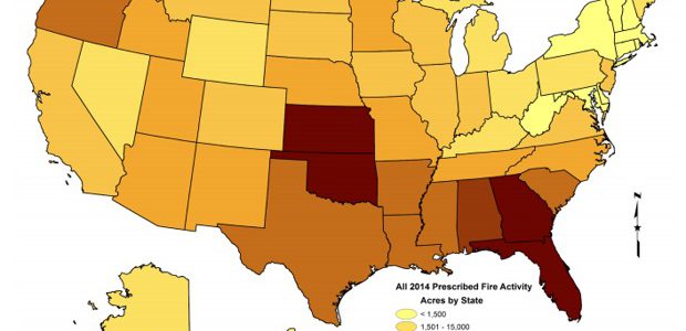
CityLab from The Atlantic magazine had an interesting story this week about how the South manages wildfires and how California could benefit from our experience. The basic difference is that the South uses controlled burns to undergrowth using low-intensity flames along carefully planned control lines. In the West, historically all fire has been suppressed, leaving to…
-
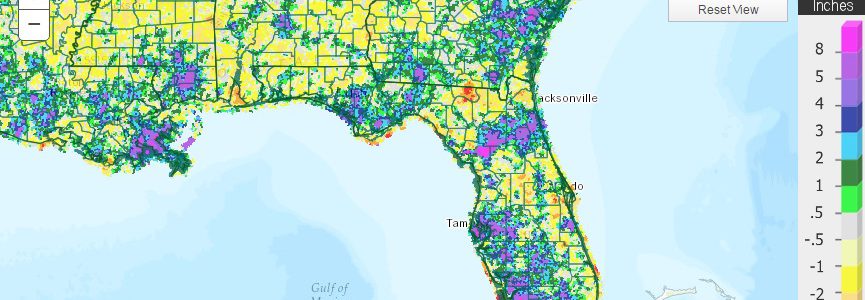
The latest monthly climate summary for Florida for June 2016 is now available at https://climatecenter.fsu.edu/products-services/summaries/climate-summary-for-florida-june-2016. As I post this, their rainfall map is missing but here is what it will look like once they put it up:
Posted in: Climate summaries