Pam Knox
-
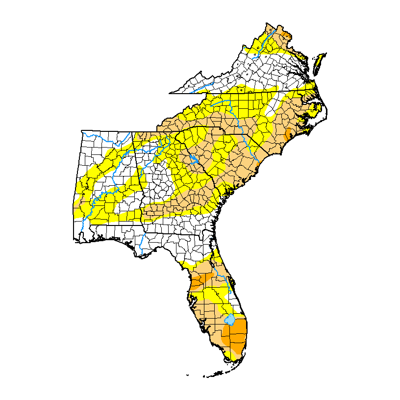
The latest Drought Monitor, released earlier this week, shows that due to some fairly substantial rains there was improvement in dry conditions in many parts of the region. However, some minor increases in dry conditions were noted in north central GA, western NC, and in Florida. The Virgin Islands continue to be abnormally dry but…
Posted in: Drought -
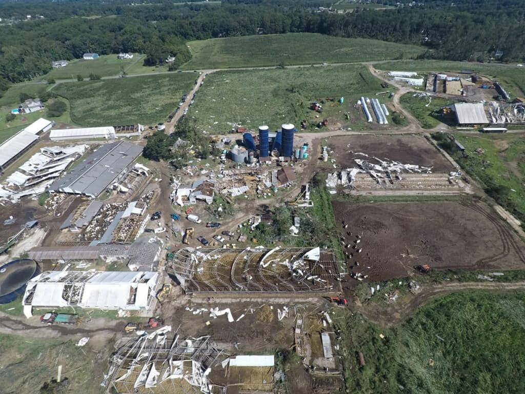
The expansive round of severe weather we had this week is a reminder that you should take time every year to prepare for extreme weather conditions, both for local severe weather and hurricanes. Preparation allows you to react more quickly to threatening conditions, allowing you to move to safety in time to maximize the chance…
-
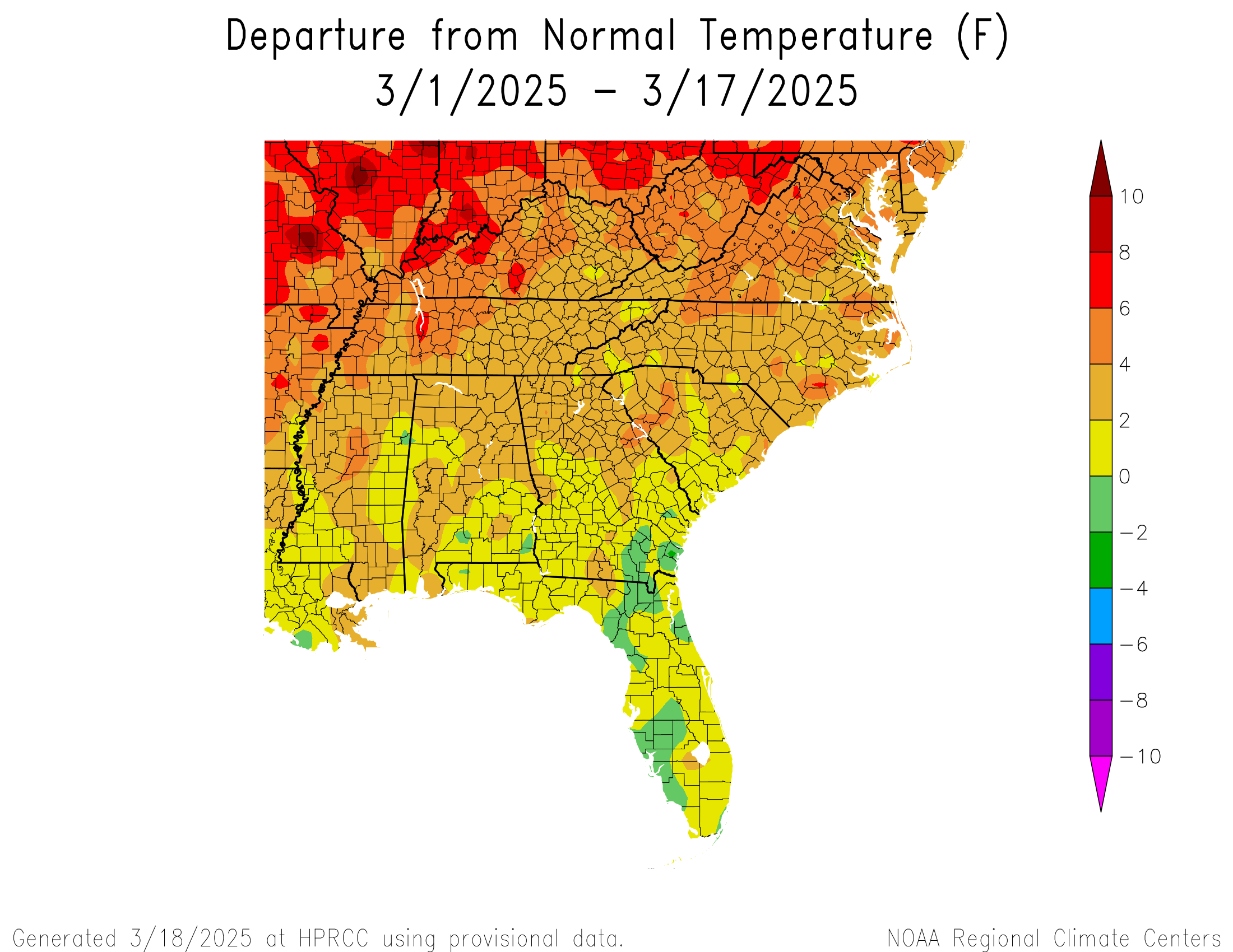
A look at the summary of climate information for March so far shows that nearly the entire region was warmer than normal, but precipitation was more varied. It was generally wetter than normal in places that would usually be fairly dry in a La Nina winter, which probably reflects how weak it is this year.
Posted in: Climate summaries -
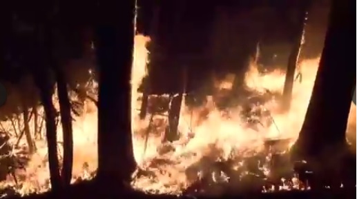
The dry conditions that have been occurring over parts of the Southeast, combined with several storms that have brought quite a bit of wind to the area, have helped fuel the development of numerous wildfires in the Carolinas as well as other parts of the Southeast. The wildfires are made even worse in the Carolinas…
Posted in: Climate and Ag in the news -
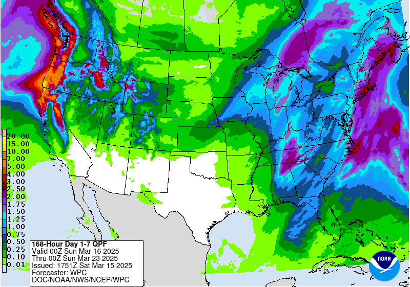
The latest 7-day QPF map shows that almost all of the rain we get this week will be with the system that is moving through on Saturday night into Sunday morning. After that, cool and dry air should move back into the region for the rest of the week with just some very light amounts…
Posted in: Climate outlooks -
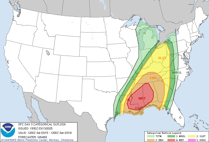
While the Southeast can get severe weather any month of the year, the highest likelihood is typically in the March through May period. Over the next few days, a large area of low pressure in the central U.S. will set up conditions that are favorable for the development of severe weather here in the Southeast.…
-
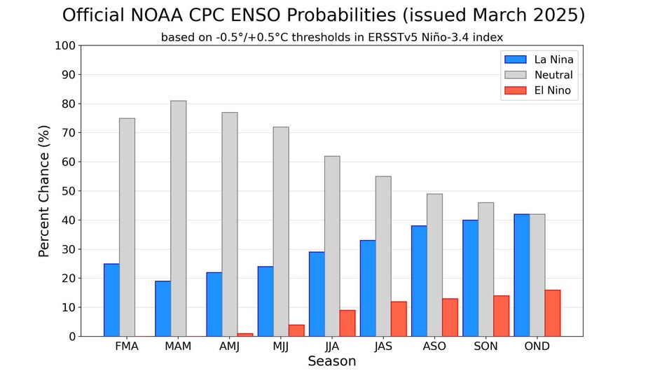
The latest ENSO outlook was released today and shows that the current weak La Nina is expected to end soon. Conditions in the Eastern Pacific Ocean will swing back to neutral conditions and are expected to stay there through the end of 2025. This La Nina was late in coming and never got very strong,…
Posted in: El Nino and La Nina