Pam Knox
-

The Climate Prediction Center issued their monthly update on the ENSO today. The report indicates that while La Nina is still present, it is just barely holding on and is expected to end in the next month, leading to the return of neutral conditions. CPC is predicting a fairly quick swing to El Nino conditions…
Posted in: El Nino and La Nina -
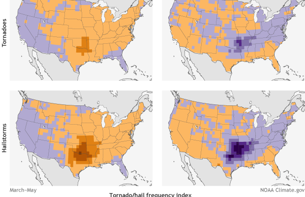
Since we are likely to be switching from the weak La Nina we are currently in to neutral and then El Nino by later this summer, Climate.gov thought it was a good idea to remind us all that La Nina and El Nino have different impacts on spring tornadoes and hailstorms as well as on…
-

The latest Drought Monitor, released today, shows only a few small changes in the map compared to last week, with slight increases in drought area overall. There were a few small areas of improvement in Alabama, Georgia, Tennessee, and Virginia. There was no change in the Puerto Rico map, with less than one percent of…
Posted in: Drought -
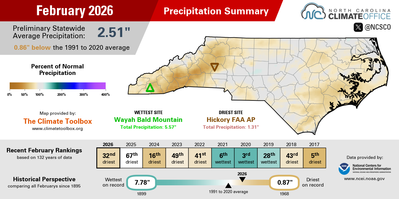
The North Carolina State Climate Office published their latest monthly summary for February 2026 online. You can read it at https://climate.ncsu.edu/blog/2026/03/snow-melted-but-severe-drought-continued-in-february/.
Posted in: Climate summaries -

The freezes that affected Florida, Georgia, and Alabama have made farmers in the affected counties eligible for emergency loans to cover losses from those counties. There were a total of five different triggering events with different sets of counties affected by each one. Applications for the loans are due by November 4, 2026. You can…
-

The latest 7-day QPF map shows that the western parts of our region are likely to get rain in the next few days, particularly in the Wednesday through Friday period. Some isolated spots in Alabama could get 2-3 inches but most areas will get less than that, and as you go east the amounts that…
Posted in: Climate outlooks -
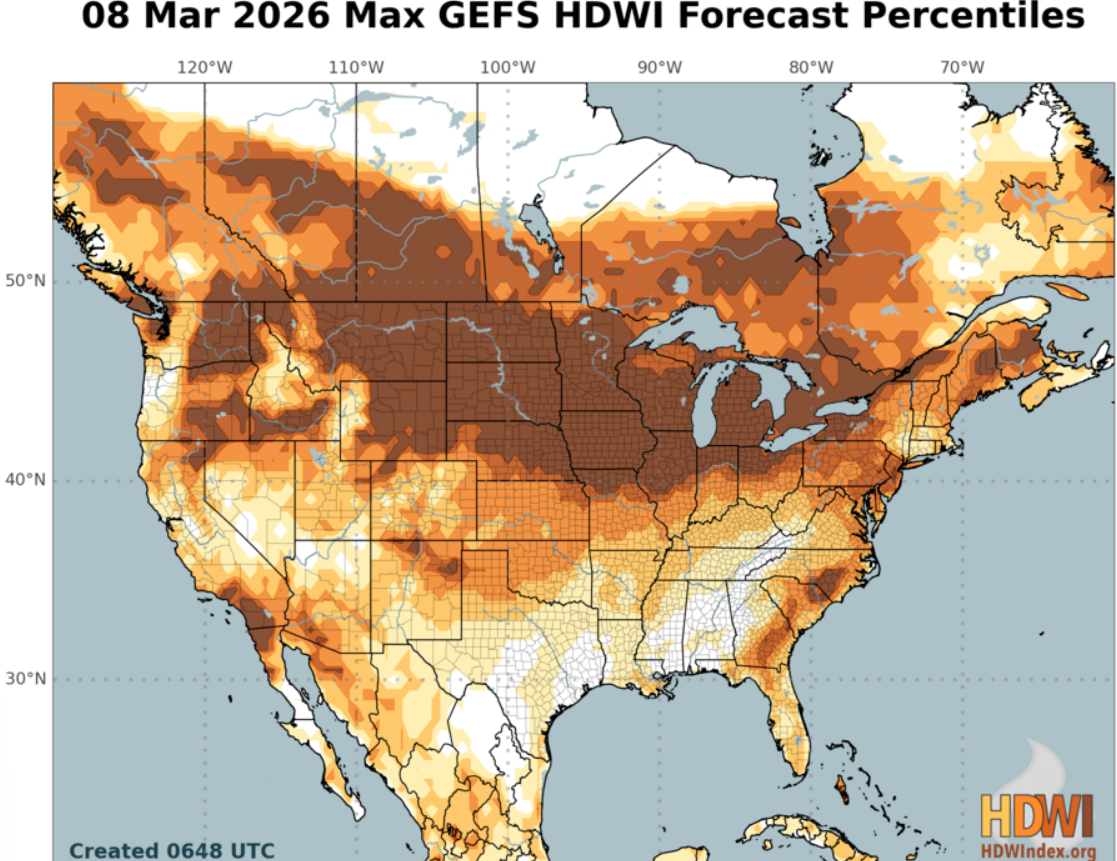
The Hot-Dry-Windy Index (HDW) is a new index produced by USDA that is now available online at https://hdwindex.fs2c.usda.gov/index.html. It was designed to help users determine which days are more likely to have adverse atmospheric conditions that make it more difficult to manage a wildland fire. It combines weather data from the surface and low levels…