Search results for: “tornado database”
-

Here is a simple-to-use database of historical tornadoes that you can sort by County Warning Area or individual county. You can also filter the data by strength and look at graphs of tornado frequency by time of day, month, and EF scale. Individual counties show maps of the historical tornado tracks. You can check it…
-
Tornado track database
Pam Knox

If you ever have to provide risk assessments for your county or city and need tornado information, this web site might help you identify historical tornadoes in your area. It’s from the Midwestern Regional Climate Center but includes information for all of the United States. It seems pretty straightforward to use. You can see it…
-
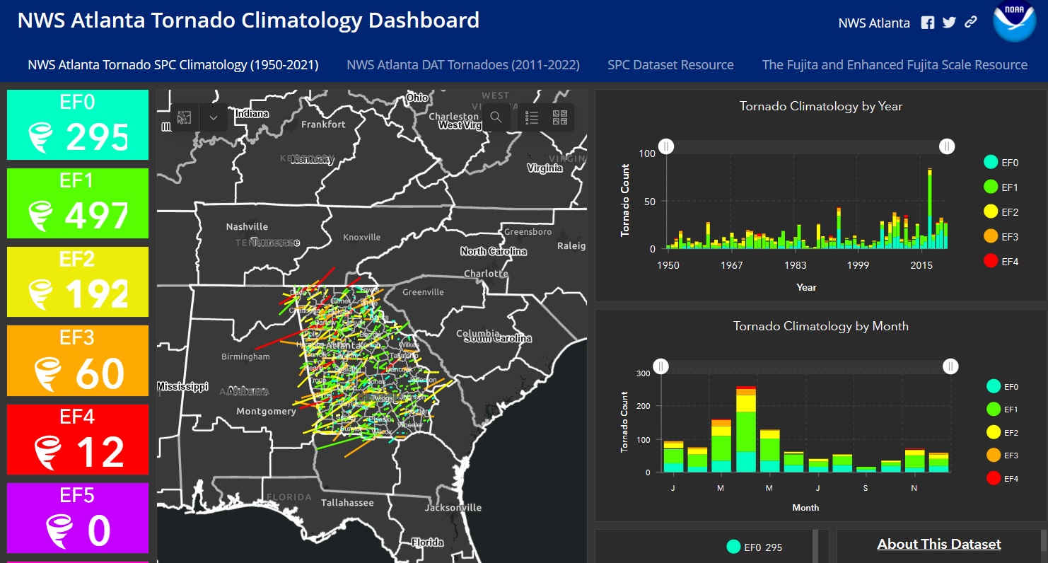
Those of you who are located in the County Warning Area for the Atlanta National Weather Service Office may be interested in trying out this new GIS-based tornado dashboard. You can check it out here. It contains tracks of all tornadoes that have occurred in those counties since 1950. The dashboard allows you to filter…
-
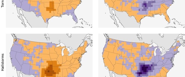
A new study released by NOAA last week shows that in El Nino years, the number of tornadoes and hail storms decreases compared to non-El Nino years. As you might expect, in La Nina years, the opposite of El Nino, severe weather increases in the Southeast. Note the split between the Florida peninsula and more…
-
Interactive tornado tracker tool
Pam Knox
Here is a neat tool for looking at historical tornado tracks across the country. It is run by the Midwestern Climate Center using the official Storm Prediction Center database and mapped onto an interactive map. You can zoom into your county and filter by date and Fujita scale of tornado. It defaults to F3 and…
-

Over the past couple of months I have received many questions about weather-related crop insurance and why the counties designated by the RMA do not match what they have experienced in their area. Producers are frustrated when they experience weather that they think clearly meets the requirements for the insurance and yet they are not…
Posted in: Tropical weather -
Where to get local storm reports
Pam Knox

When severe weather hits, the National Weather Service collects the information and issues Local Storm Reports for the storm events that are called in. They are usually posted on each station’s web site. However, they are text files and it is not always easy to find a report for a specific location. There are several…
Posted in: Sources of weather and climate data