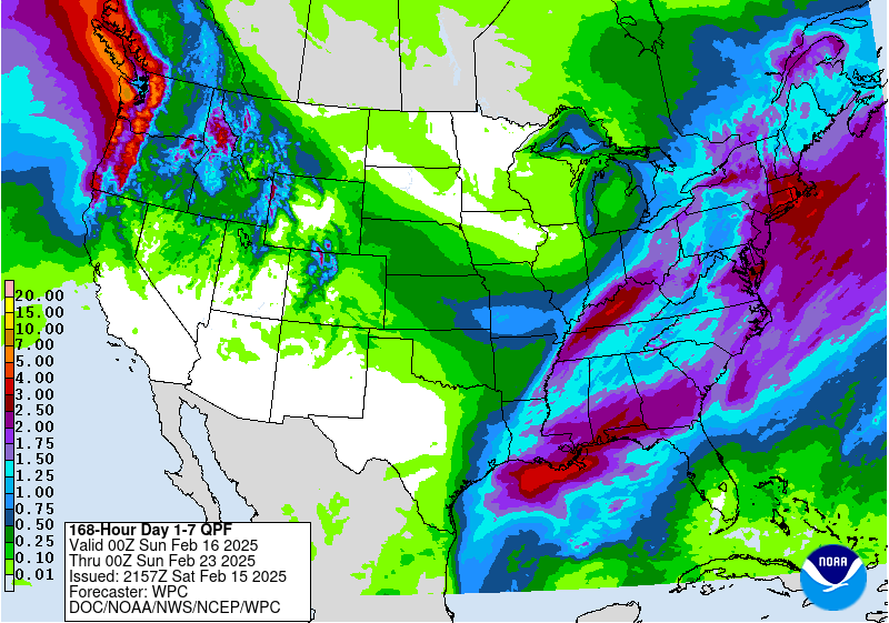
The latest 7-day QPF map shows a bifurcated pattern in the rainfall this week due to two storms that will pass over the Southeast. The first of them is moving into Alabama tonight and will progress through the region on Sunday. I expect to get some rain early in the morning on Sunday a few hours after this blog post is emailed out. It will continue to the east over the day and could bring severe weather to some locations. After that moves through, we will have dry weather on Monday and Tuesday before the next big storm moves through on Wednesday. It should move into Alabama overnight Tuesday into Wednesday and progress rapidly along a path similar to where the snow fell a few weeks ago in southern AL and GA, although this time it will be all rain and no frozen precip except in northern regions including Tennessee, North Carolina, and Virginia.
By Thursday morning the precip should be out of the region except for some lingering snow showers in Virginia. There will be some cold air on Monday and Tuesday but the bigger threat of freezing weather will be after the second storm. Models vary as to how cold it will get but anyone in northern Florida or points to the north of that should watch temperature forecasts for next week Friday through the following Monday carefully if freezing conditions could affect your vegetables or blueberries.