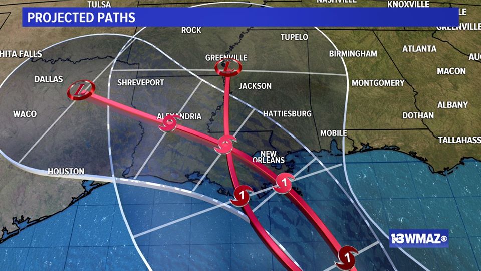
The latest projected path of TS Laura, which is now just west of Puerto Rico, is for it to follow along Hispaniola and and Cuba before entering the Gulf of Mexico. The southern tip of Florida could see some winds and rain from the storm, but most of the peninsula will avoid the heaviest winds. Laura is then expected to move NW and make landfall somewhere along the Louisiana coast on Wednesday night. Since Georgia and Alabama will be on the eastern side of Laura, they will experience some heavy rains, gusty winds and possible tornadoes but should miss the worst effects. As Laura curves back to the NE, it could cause some additional effects in northern AL and GA on Thursday into Friday, but Laura should be a depression then, with much lighter winds.
The biggest threat now is for Louisiana, which will not only likely have to contend with Laura on Wednesday night, but which will have experienced the effects of Marco on Monday night. Both of them could be hurricanes when they make landfall, a 1-2 punch that is unprecedented in modern history. It will be a severe test of how well they repaired their flood protection after Hurricane Katrina in 2005. Of course there are still likely to be some changes in predicted track and intensity, so this may not happen, but it bears careful watching.