August 2020
-

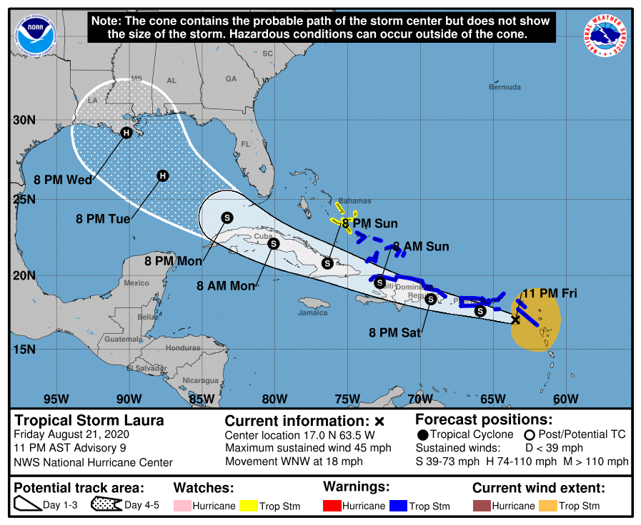
The latest projected path of TS Laura, which is now just west of Puerto Rico, is for it to follow along Hispaniola and and Cuba before entering the Gulf of Mexico. The southern tip of Florida could see some winds and rain from the storm, but most of the peninsula will avoid the heaviest winds.…
-

If you like bubbly wine, then you may be interested in this article from Forbes.com on this year’s champagne harvest. According to the report, the annual Champagne harvest began August 17, two weeks sooner than last year following a summer of drought. The summer was also warmer than usual, which contributed to the rapid ripening…
-
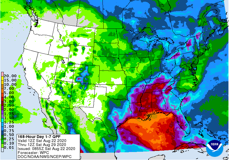
With two tropical storms expected to be in the Gulf of Mexico this week, it should be no surprise that most of the rain we are likely to get is linked to those two rainmakers, especially in the states near the Gulf. This morning’s 7-day QPF map shows that there is a lot of rain…
Posted in: Climate outlooks -
As of 11 pm on August 21, Tropical Storm Marco has formed southeast of the Yucutan Peninsula of Mexico and is expected to slowly strengthen and move NW near the tip of the peninsula before continuing into the western Gulf of Mexico. It is expected to make landfall as a tropical storm along the Texas…
-

I am pleased to say that I have a new article out in Weatherwise magazine today. It is a summary of the weather and climate of Georgia and was written with co-author H. Michael Mogil. Looks like I have run out of free downloads, but if you want to see the draft copy, let me…
-

The latest monthly and seasonal outlooks for September through November were released this week and show that both the September and September-November are likely to be wetter than normal along the coasts because of the active tropical season. Temperatures in the fall are also likely to be warmer than normal due to the long-term trend…
Posted in: Climate outlooks -
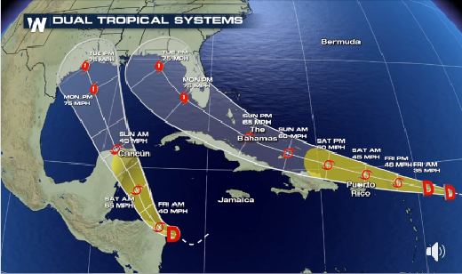
As you may know, there are two tropical depressions currently active in the Atlantic basin and they are both expected to strengthen to named storms and eventually hurricanes as they approach the Gulf of Mexico. TD14, the western depression, is predicted to move NW and cross the Yucutan Peninsula of Mexico before moving into the…