2018
-
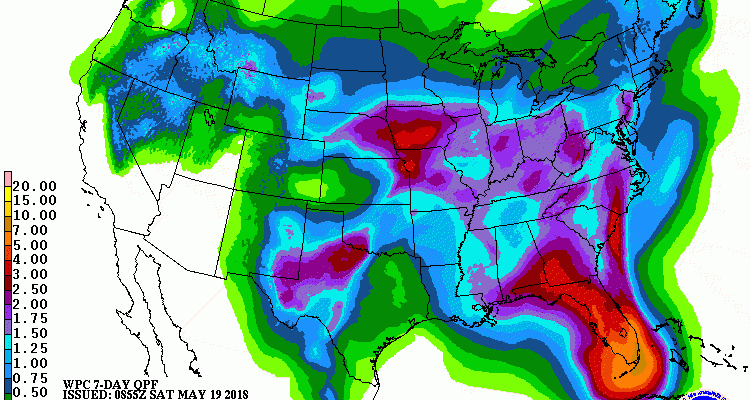
The latest 7-day QPF forecast indicates that the current rainy pattern is likely to continue for at least the next week, with rainfall amounts of up to several inches of rain in isolated locations likely to occur as scattered showers and thunderstorms continue to move through the region. The highest amounts of rain are expected…
Posted in: Climate outlooks -
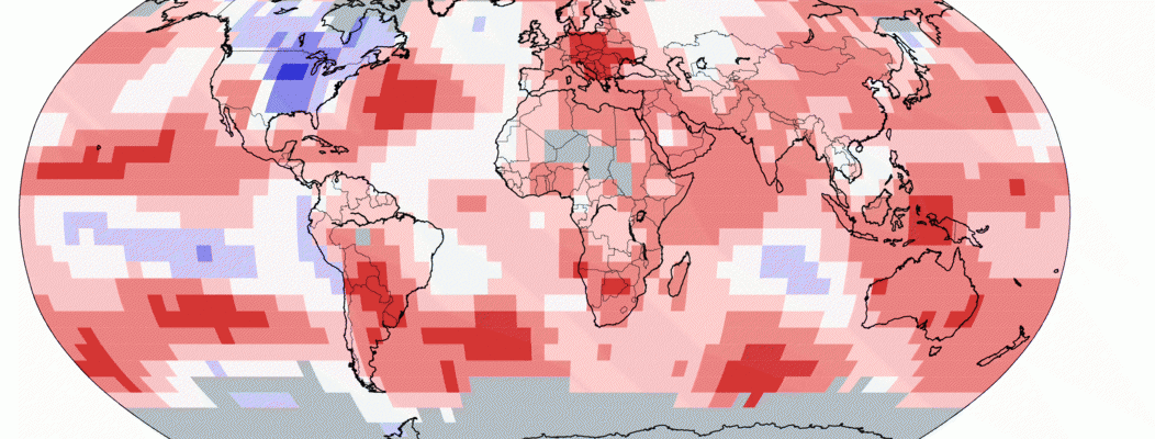
The latest global climate summary from NOAA for April 2018 shows that this month was the third warmest April since records began in 1880, surpassed only by 2016 and 2017. This makes 400 months in a row with temperatures that were at least slightly above the 20th century average. Temperatures were buoyed by a very…
Posted in: Climate summaries -
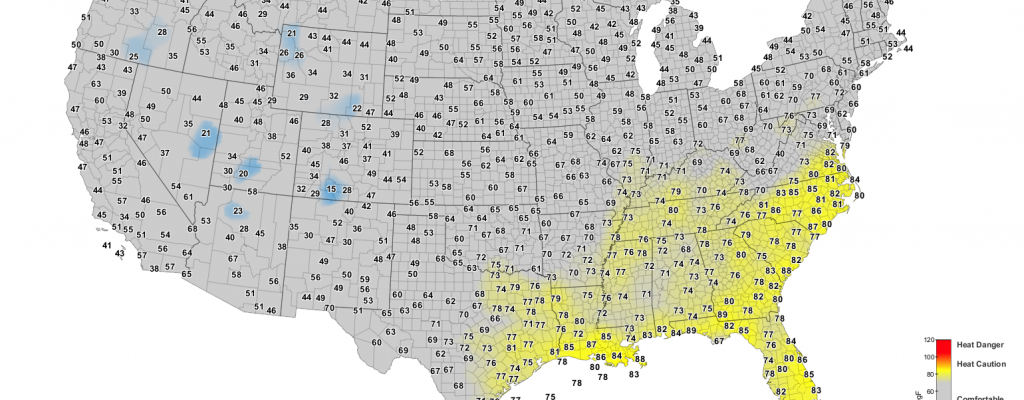
Drovers Newsletter has a timely article this week on cattle heat stress and when it is too hot to work cattle, and especially calves, which are more susceptible to stress than full-grown animals. You can find it here along with links to sources of cattle heat stress maps (or go directly to the Cattle Comfort…
-
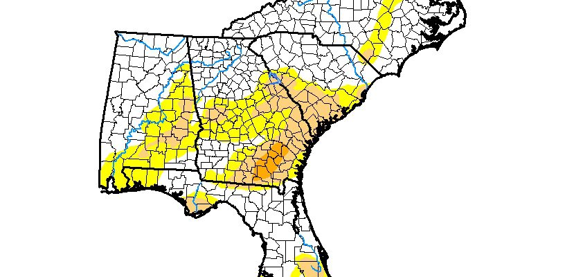
The tropical system which has been moving north through the Southeast this week has reduced severe drought in southern Florida in the latest Drought Monitor map, but drought in other areas remained the same as of the cutoff date on this past Tuesday. The rain that has fallen since then is likely to reduce drought…
Posted in: Drought -

NOAA reported this week that they have detected an increase in the production of chemicals that were banned due to their impact on high-altitude ozone. This indicates that someone has begun producing it again. The study narrows it down to somewhere most likely in eastern Asia. This is bad news because the reduction in the…
-
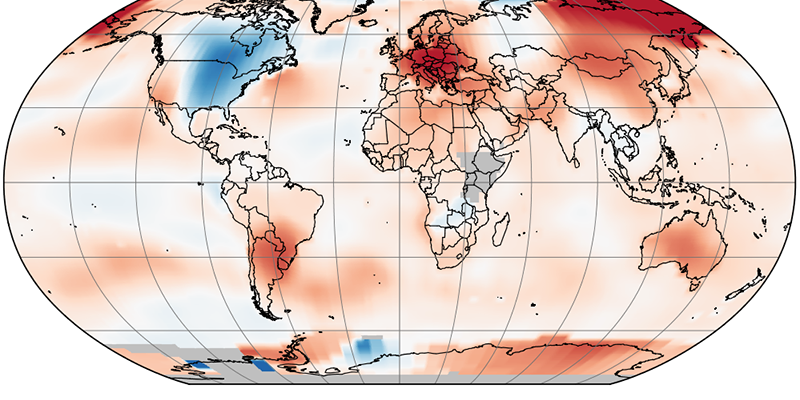
NASA released their monthly climate summary for the globe today. It shows that for the earth as a whole, this is the third warmest April in 138 years of record, falling below only 2016 and 2017. Note that the only place on earth that was below the long-term average this year was the eastern half…
Posted in: Climate summaries -
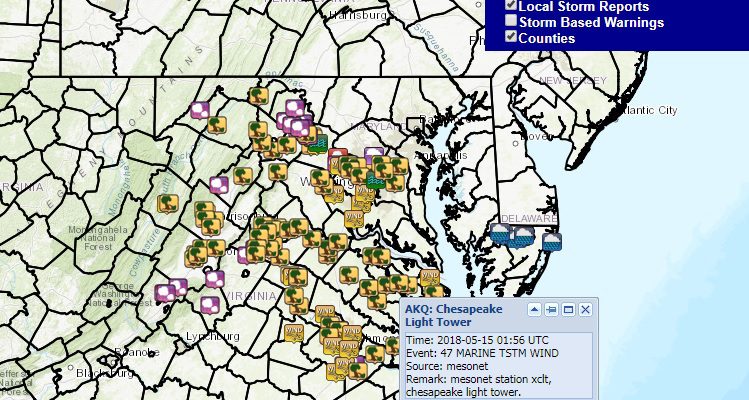
The National Weather Service puts out local storm reports for events like high winds, tornadoes and hail in text form, but that is not always useful when you are trying to find severe weather at specific locations. This interactive map for the Southeast will provide severe weather reports that you can use to find occurrences…
Posted in: Sources of weather and climate data