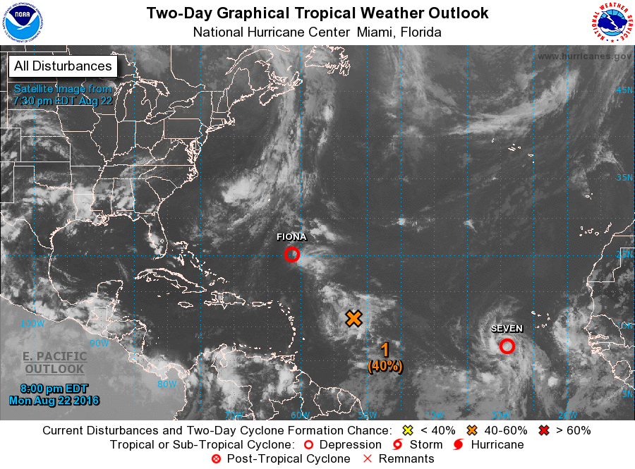
The tropics are becoming more active, and the National Hurricane Center is watching three tropical waves in the Atlantic now, with a fourth one coming off the coast of Africa in the next few days. Tropical Depression Fiona is still around in the Atlantic far from land but is expected to degrade into a remnant low in the next day or so. A new tropical depression (#7), formerly known as Investigation #90L, has formed in the eastern Atlantic today and is expected to become TS Gaston in the next day or so. Gaston will most likely curve northwest and is not expected to affect land. (11 PM update–TD 7 has now officially become TS Gaston and is expected to become a hurricane within 36 hours).
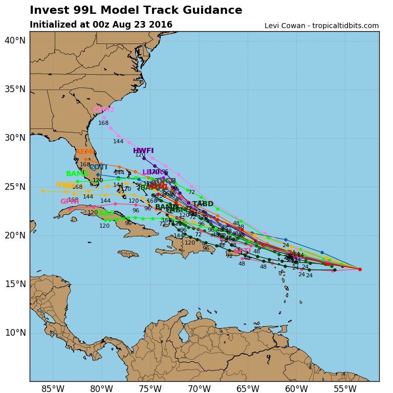
The third system, known as Investigation #99L, is organizing east of the Lesser Antilles, and according to most of the forecast models, has the potential to track through the Bahamas by early next week. The models don’t agree on where it will go after that, but somewhere on the East Coast is certainly possible. If you have outdoor activities early next week and you are in Florida or along the coasts of Georgia or the Carolinas, you will want to keep track of what is happening with the storm. Depending on where the storm goes, heavy rain is also a possibility. Again, this is a long time from now, so there is no need for immediate worry, but it is something to keep an eye on.
An excellent discussion of the current status of the storms can be found at Weather Underground here (it was written before 90L became TD 7, so keep that in mind when you read it). The suite of model tracks from various forecast models is shown below. Remember that forecasts this far out can change significantly over time so don’t use these tracks for planning purposes. You can get updated information at https://www.hurricanes.gov or at https://www.spaghettimodels.com. I will also post updates on the blog as the wave develops and gets closer.