-
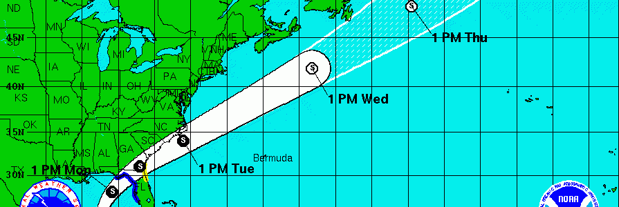
The National Hurricane Center noted the official development of Tropical Storm Colin this afternoon at 5:30 EDT. This is the earliest ever in the season for a third named storm. Colin is forecast to continue to develop and move off to the northeast over the next few days. It is expected to land on the Florida…
-
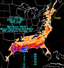
Back in June 2001, Tropical Storm Allison dropped immense amounts of rain across Texas before the remains of the storm moved slowly across the Southeast, causing flooding and damage from tornadoes across a wide swath of the eastern US. As with many tropical storms, winds were not the main impact of the storm–instead the heavy…
-

NASA provides a lot of spectacular images from space, but also does a lot of research on changes in the earth’s surface due to human activity as well as changes in climate on different time scales. Here are a couple of examples I ran across this week. Vox.com posted a story based on NASA’s Earth…
Posted in: Climate science -
Weather Underground‘s latest blog lists ten myths about hurricanes that are not true. Since the tropical season has already started, it’s important to know about the storms that could affect us here in the Southeast (and beyond!) this summer. You can read the list at https://www.wunderground.com/news/hurricane-myths-debunked-2016#prclt-FiGV1ecp.
-
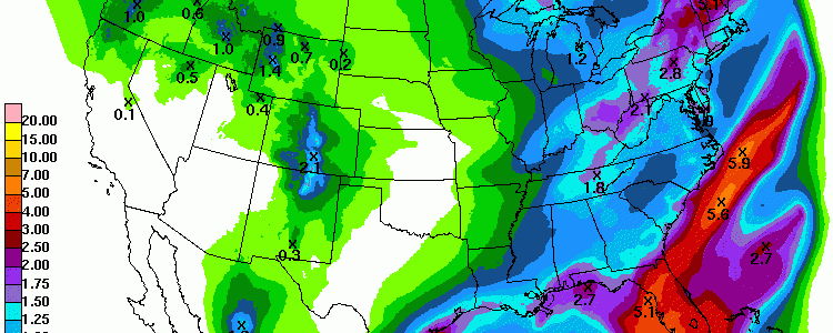
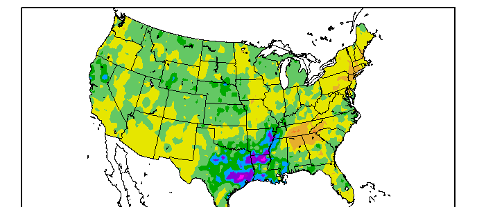
The latest 7-day QPF shows that the Florida panhandle is going to be the wet spot this week as likely Tropical Storm Colin develops and crosses the peninsula early next week. Rainfall of over 5 inches may be seen in some areas. Elsewhere in the Southeast, most areas will see at least an inch of…
Posted in: Climate outlooks -
Spring is officially over (climatologically speaking) and now we look forward to summer. I often get asked whether a hot spring means a hot summer, or some other permutation of that question. Often, there is no correlation between seasons. However, in the latest “Beyond the Data” blog entry from Climate.gov, Deke Arndt discusses the impact of a…
-
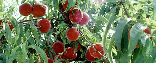
Growing Georgia reported that the Georgia Farm Bureau is expecting a bumper crop of peaches this year. Even though December was very warm, cold temperatures in January and late February brought enough chill hours to get the peach trees ready to bloom, and a feared late frost did not materialize, leading to good production for…