-
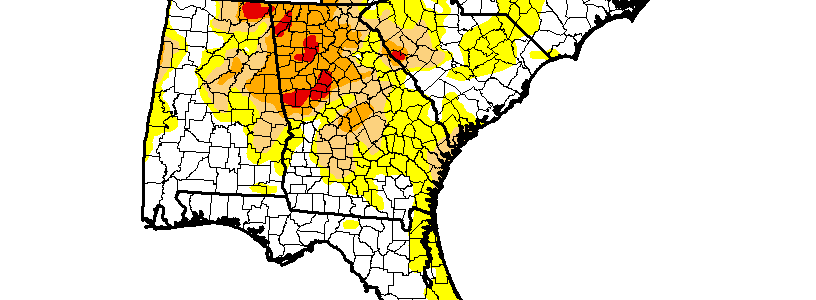
This week’s Drought Monitor shows an expansion of abnormally dry conditions in southeastern Georgia and parts of North and South Carolina in the last week. However, Hurricane Hermine is expected to move directly over those areas in the next two days, so those dry conditions should be completely wiped out by next week’s Drought Monitor.…
Posted in: Drought -
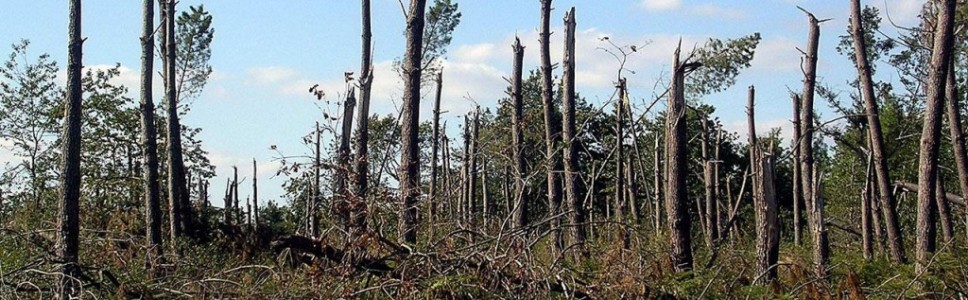
Since Hurricane Hermine is coming onshore soon, there is bound to be a lot of damage to trees across the Southeast. Here is an interesting article from Inside Science on how and why trees break. In the case of a hurricane, a lot of tree damage also comes not from the tree breaking but being…
Posted in: Forests -

Even though astronomers use the autumnal equinox as the marker for the official start of fall, climatologists use September 1. Historically it made calculations a lot easier and better represents the transition from the three hottest months to the cooler fall. And just in time comes some cooler weather, which you should see in the…
Posted in: Events -
Apologies to those readers who are not in the Southeast–one last blog post on TS Hermine. The 11 pm outlook for Hermine shows that the storm has strengthened somewhat over the evening and is now expected to come ashore as a hurricane. The path has shifted ever so slightly to the east due to the latest…
Posted in: Tropical weather -

AgWeb had an interesting story today on how some farmers are finding meteors in their fields as rocks rise to the surface each year under the influence of repeated frosts. If they are big, they can be sold to a collector or donated to a local museum. You can read about it here.
-

One of the amazing things about this summer (to me) has been the unrelenting nature of the heat this year. We’ve had very few days over 100 F and most days were nowhere near a record temperature for the date, but the number of runs of days above thresholds like 90 F for max temperatures…
-
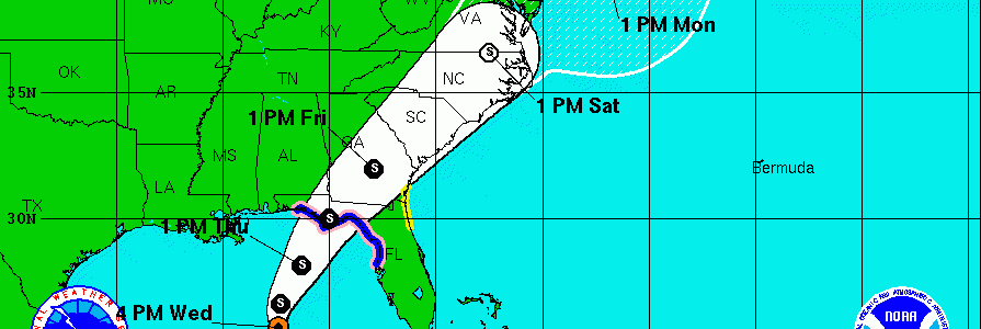
The 5 pm forecast from the National Hurricane Center shows a significant shift of the forecast cone to the west from earlier in the day. It puts the center of the track just southeast of Macon at 1 pm on Friday. The cone itself covers the southeastern 2/3 of Georgia, so anyone driving through that…
Posted in: Tropical weather