-

In news this week, it was reported that NASA as well as other government websites will no longer provide copies of the National Climate Assessments that are produced every four years at the request of Congress. I was an author of the Southeast chapter of NCA5. The group of authors that was starting to work…
-
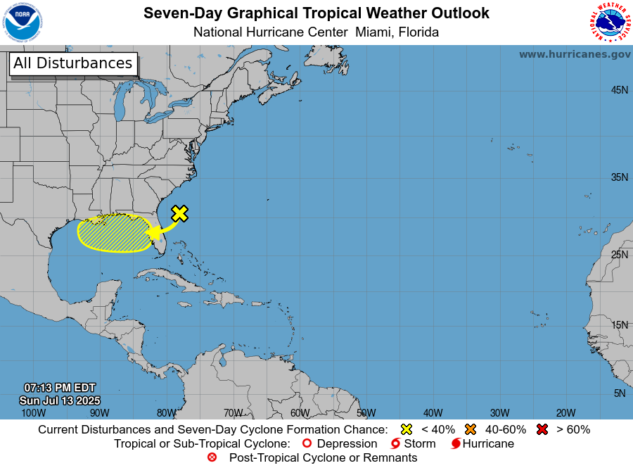
This week a new area of disturbed weather formed in the Atlantic Ocean southeast of our region. It has some thunderstorms but there is no closed low or much of a circulation at this point. The area is expected to move gradually westward over the next few days and will drop quite a bit of…
Posted in: Uncategorized -

Here in this blog, we don’t just talk about the impacts of climate on agriculture (or vice versa). We also share information about how climate may have affected other aspects of society. This story from Atlas Obscura describes how languages developed “soft” or “loud” sounding words depending on what the prevailing climate of the people…
Posted in: Uncategorized -
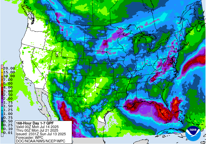
The latest 7-day precipitation map shows that the heaviest rain this week will fall in northern Florida and along the Appalachian Mountains and north into a good bit of Virginia this week. The Florida rainfall is associated with a disturbance that is currently off the East Coast that is expected to move westward over the…
Posted in: Uncategorized -
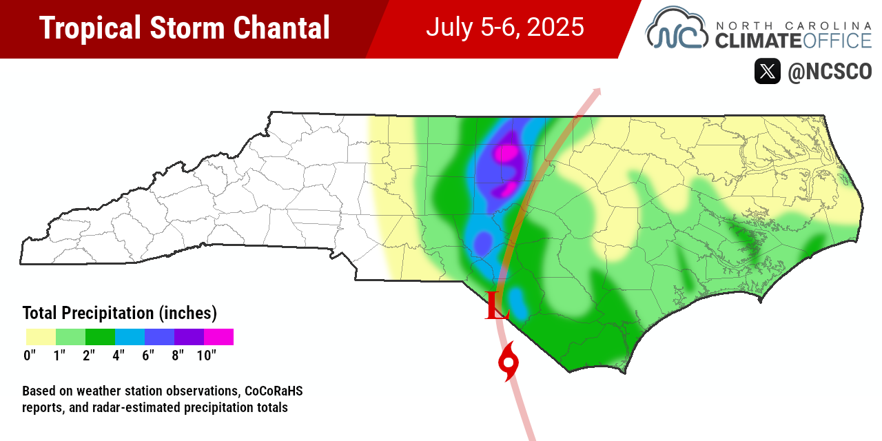
Our friends at the North Carolina State Climate Office produced a quick overview of the rainfall from Tropical Storm Chantal and posted it to their blog earlier this week. Our son Evan, who lives near the Duke Forest in Durham, reported that their ground-floor apartment had water in it, and according to the report that…
-
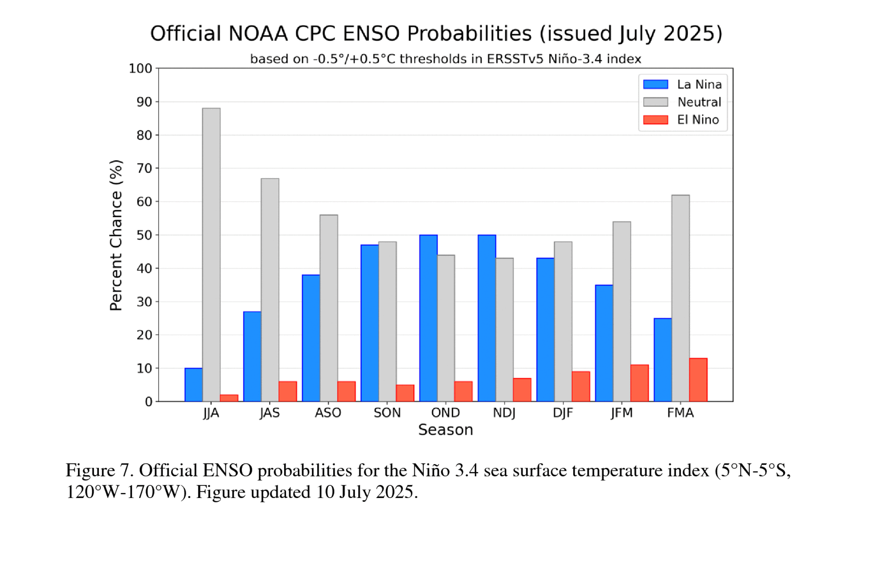
NOAA’s Climate Prediction Center released their latest outlook for ENSO today at https://www.cpc.ncep.noaa.gov/products/analysis_monitoring/enso_advisory/ensodisc.shtml. It shows that neutral conditions are likely to continue through most of the next year, with an almost even chance of going back to a La Nina over the late fall and early winter. El Nino has a low probability of occurrence…
Posted in: El Nino and La Nina -
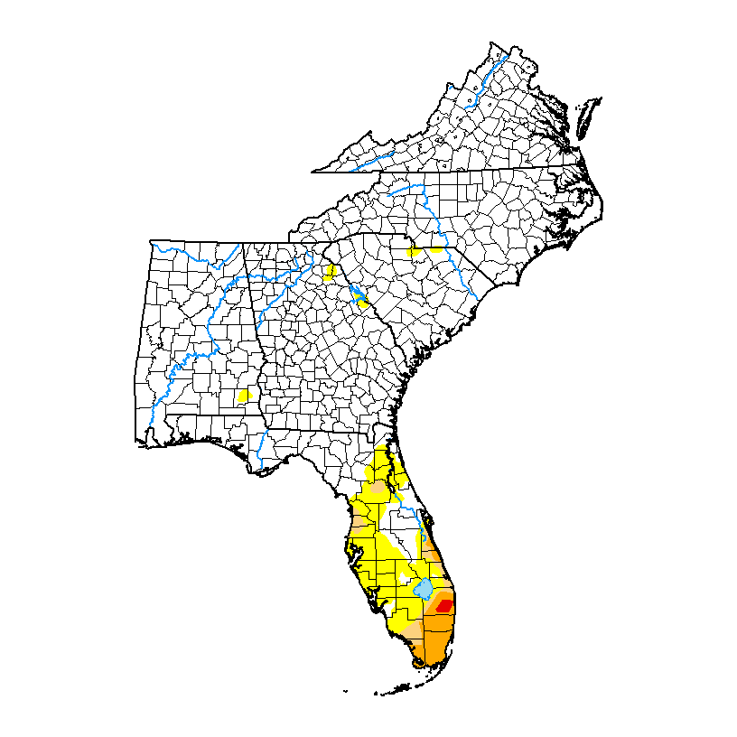
The latest Drought Monitor, released today, shows that much of the Florida Peninsula has improved in drought status with the recent rains that have fallen there. Only the southeast part of the state has seen dry conditions expand. Elsewhere in the mainland region, a few small areas of abnormally dry (D0) conditions have appeared due…
Posted in: Drought