Sources of weather and climate data
-
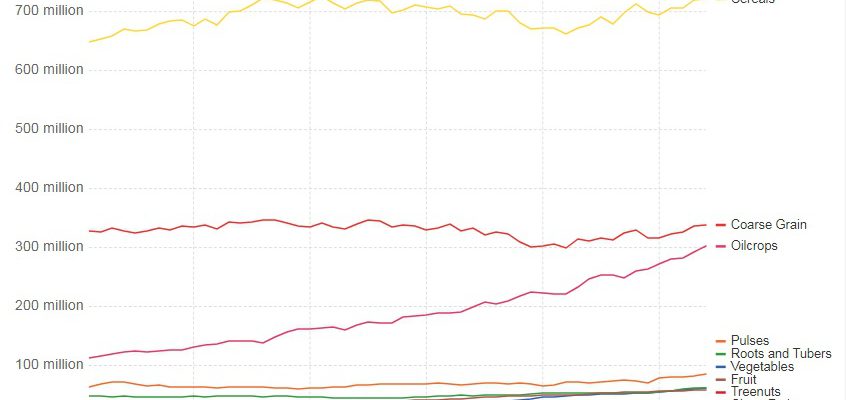
Our World in Data has a fascinating look at global production of many different crops at their website https://ourworldindata.org/yields-and-land-use-in-agriculture/. You can use the information to see how yields in different crops have changed over time or see how production varies from one country to another. While it does not break down individual countries into smaller units…
-

Many older weather records exist, but because they are stored in ship logs, on paper, or in museum log books, we can’t use them to do modern scientific studies with. If we had access to the data, it would give us a clearer look at long-term weather patterns that we can’t do now. Because of…
-

Considering that Hurricane Irma is now up to 180 mph winds and is expected to affect parts of the Southeast in the next week, now might be a good time to download the NOAA extreme weather information sheet for your location. They provide regularly-checked phone numbers for emergency contacts in each area as well as…
Posted in: Sources of weather and climate data -

If you are interested in seeing what tropical storms have passed close to your location in the past, you should try out NOAA’s Hurricane Track archive at https://coast.noaa.gov/hurricanes/?redirect=301ocm. It allows you to select a location and a radius of interest and provides information on all of the storms that have passed within that circle since…
-
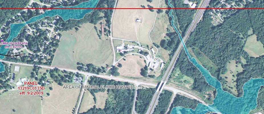
If you are following Hurricane Harvey, you know that one of the hazards most likely from the storm is torrential flooding rains. People in Texas have been warned that if they live in a flood plain, they should evacuate. Of course in the case of Harvey, there is likely to be so much rain that…
-

Following the disaster that was Hurricane Katrina (which was developing on this date in 2005), NOAA prepared a series of information sheets for residents to use. Each sheet provides local phone numbers and contacts for emergency managers and other resource centers in their areas in case of extreme weather. With Tropical Depression Harvey restrengthening in…
Posted in: Sources of weather and climate data -
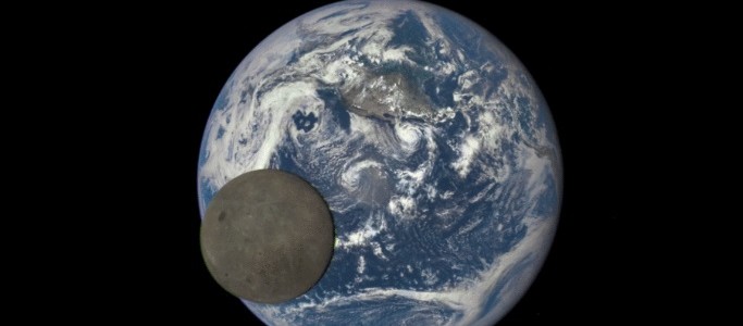
If you want to see a view of the eclipse shadow from space on Monday, there are a number of web sites which provide a great view. One was put together by Brian McNoldy at the University of Miami at https://andrew.rsmas.miami.edu/bmcnoldy/conus/. There will also be some great satellite loops from the University of Wisconsin Space…