Interesting weather images
-

A rare occurrence of a tropical cyclone (equivalent to a hurricane in the Atlantic) making landfall on the Arabian peninsula is expected to occur this week as Chapala moves west towards Yemen and Oman. Some areas of the desert countries could receive up to 8 years’ worth of rain in 1 to 2 days. Chapala…
-
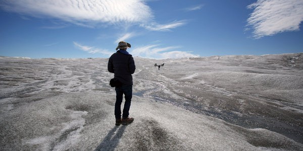
The New York Times published some spectacular pictures of the ice melting in Greenland this summer which were taken by a drone. You can see these images at https://www.nytimes.com/2015/10/28/insider/a-drones-vantage-point-of-a-melting-greenland.html?_r=0 and read more about how the video was taken at the Huffington Post here. If you are interested in why the melting of the Greenland ice sheet is…
-

Along the East Coast today many roads were underwater from a combination of extremely high tides, onshore flow, remains of the flooding in South Carolina, and rising sea levels. A number of roads were forced to close, including the access to Tybee Island along the Georgia coast near Savannah. This is the third time in…
-
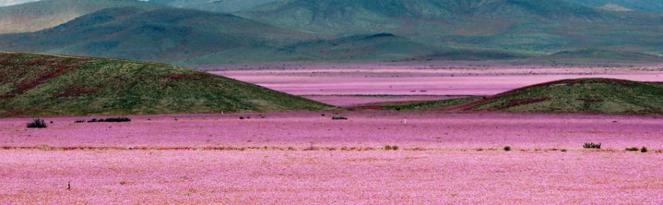
The Atacama Desert in Chile, normally one of the driest places on Earth, was recently photographed covered by millions of pink mallows. Heavy rains in March provided some areas with up to seven years’ worth of rain in 12 hours. You can see pictures and read a description here. While the story does not say…
-
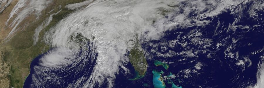
The satellite and streamline maps today show a newly developed coastal low pressure center (which spun up from the remnant circulation of former Major Hurricane Patricia) as it moves east across the Southeast today. You can see the dynamic version of the streamflow analysis at https://earth.nullschool.net/. The swirl of winds ahead of the storm’s center…
-

If you like to watch satellite loops of interesting weather, you will enjoy the submissions for the CIMSS (Cooperative Institute for Meteorological Satellite Studies) for their 40th anniversary celebration. You can see them all at https://cimss.ssec.wisc.edu/goes_40th/contest/results.html.
-
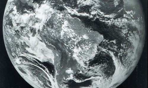
Forty years ago today, on October 16, 1975, NOAA’s first Geostationary Operational Environmental Satellite was launched from Cape Canaveral Air Force Station in Florida. Known as GOES-A when it launched, the satellite was designated GOES-1 once operational. GOES stands for Geostationary Orbiting Earth Satellite. GOES-1 returned its first image only nine days later on October 25,…