Interesting weather images
-
The Sightline Institute published a unique resource on climate change back in 2013 that just came to my attention. Dr. Greg Johnson, a Northwest oceanographer, published a set of 19 illustrated haikus which summarize the latest IPCC report on changing climate. Take a look at the beautiful artwork and see how succinctly this very large…
-
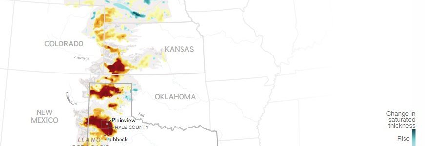
Groundwater supplies much of the irrigation water in the central Plains of the United States. A lot of this comes from the Ogallala Aquifer. National Geographic produced an interesting set of graphics on the aquifer recently that you might be interested in looking at. You can view it here.
-
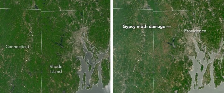
NASA’s Earth Observatory posted a striking pair of pictures recently showing the massive defoliation caused by gypsy moth caterpillars in Rhode Island. It’s amazing to me how much damage the caterpillars were able to do to the tree canopy there in just a month. You can read about it and see the pictures in more…
-
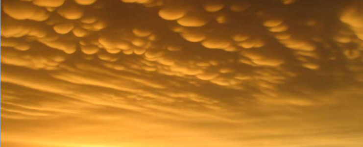
Dr. Marshall Shepherd of UGA published a new column in Forbes.com this week about mammatus clouds, the beautiful and sometimes scary clouds that form on the undersides of severe thunderstorms (and occasionally in other places as well). You can read his blog post here. The Cloud Appreciation Society also has some great pictures of mammatus…
-

Rainfall from the soggy tropical storms Bonnie and Colin has caused flooding on fields in some areas of the Southeast. The Southeast Farm Press provided a photo gallery of some of the flooding in eastern NC, taken by Rod Gurganus, North Carolina State University Extension director in Beaufort Count. You can see them all here.
-
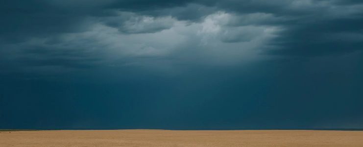
The Washington Post had a beautiful and haunting photo essay on growing wheat in Colorado earlier this week. The photos are by Elliot Ross and the story is by May-Ying Lam. Enjoy it here.
-
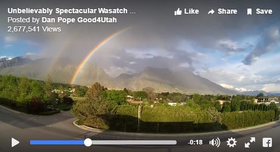
If you like rainbows, you are sure to like this beautiful time lapse video of a double rainbow over the Wasatch Mountains in Utah earlier this week. You can view it at the Capital Weather Gang here.
Posted in: Interesting weather images