Climate outlooks
-
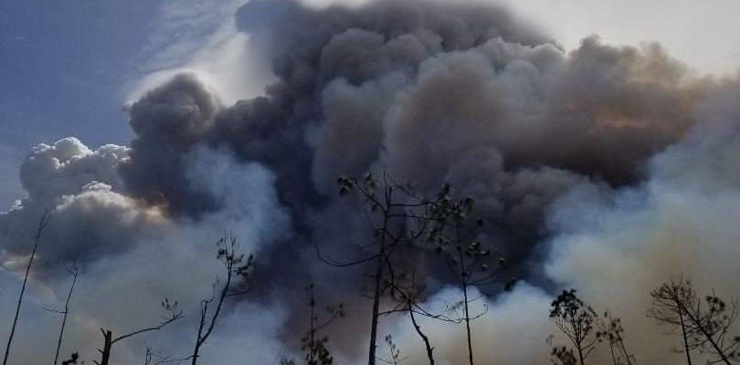
The combination of a strong La Niña and a long-term trend towards warmer temperatures means that Florida could see warm and dry conditions over the winter and an increased chance of fires next spring, according to a recent article in Florida Today. April is usually when fires are most common, and this coming year could…
-
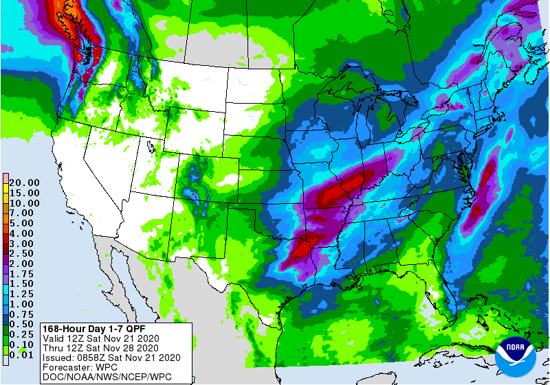
The latest 7-day QPF map shows that there will be rain over this weekend lingering into mid-week in Alabama, Georgia, and along the Appalachians, but the Florida peninsula and the coastal plains of Georgia and South Carolina will be mostly missed, adding to their abnormally dry conditions. By the end of the week, dry conditions…
Posted in: Climate outlooks -
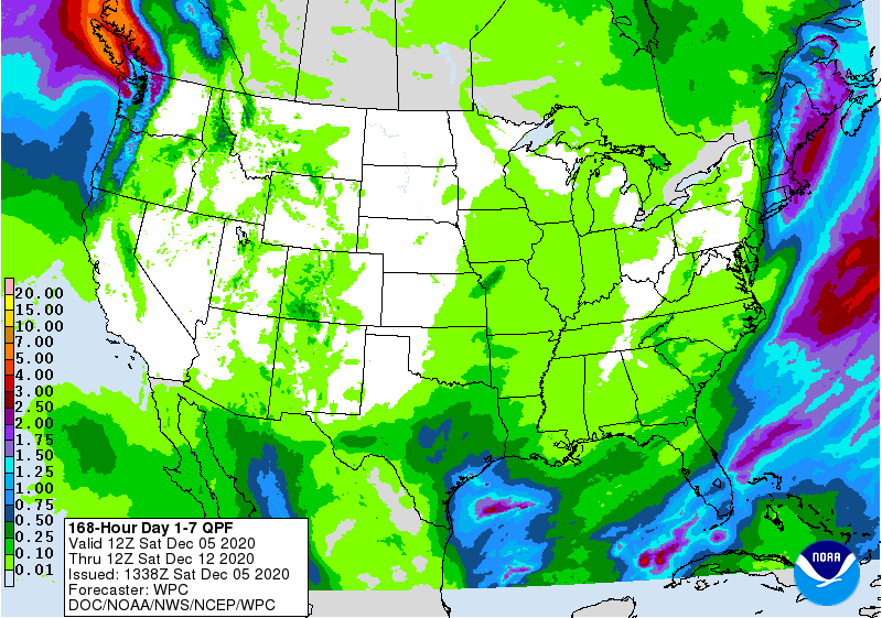
The latest 7-day QPF map shows that very little rain is expected this week, mostly on Sunday and Monday. After that, the week looks dry for everywhere but southern Florida. Normal rainfall is expected for week two before drier conditions return for the end of the month. With this little rain in the forecast, abnormally…
Posted in: Climate outlooks -
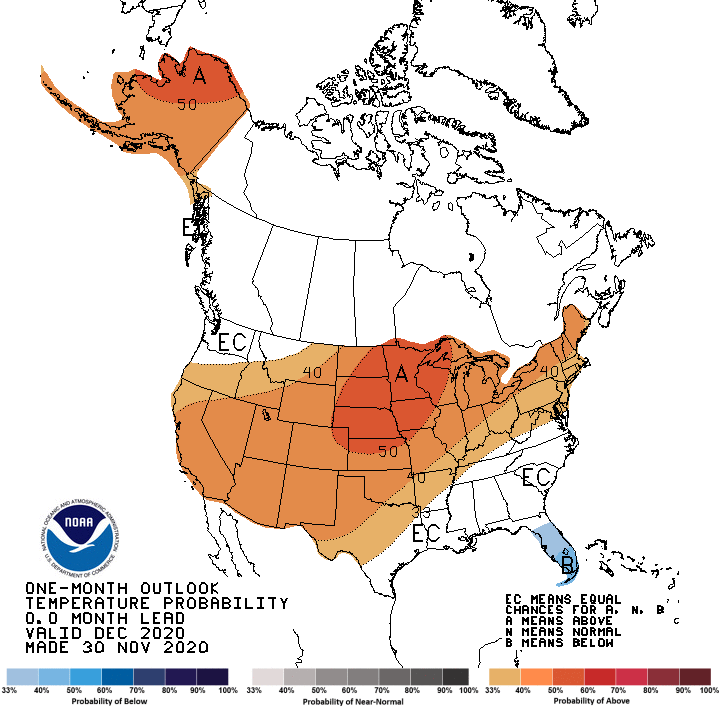
The latest 30-day climate outlook for December was released today by NOAA’s Climate Prediction Center. It shows that there is no strong trend towards warmer or colder conditions in December except in southern Florida. We know early December will be colder than normal, but late December is still expected to be warmer than normal so…
Posted in: Climate outlooks -

This week should be fairly wet for most of the Southeast, with the exception of southern Florida. One system will move through this weekend, bringing rain to the region and perhaps some snow in the higher elevations and northern states. Frost will end the growing season for many parts of the region except those near…
Posted in: Climate outlooks -

We are later than usual for the first frost of fall in a lot of the Southeast. That is going to change next week with a blast of cold air moving into the region. We could see temperatures dip below freezing for parts of the Southeast Monday night into Tuesday morning. High temperatures in Athens…
-
The latest 7 day QPF map shows that most of the Southeast will be quite dry this week, with the wettest areas on the east coast of Florida and up along the East Coast as well as in AL and in northern GA. The wettest period will be Wednesday through Thursday as a cold front…
Posted in: Climate outlooks