NOAA’s Climate Prediction Center posted their latest seasonal outlook today. The pattern it shows for the next month and three month periods are very consistent with what we expect from a weak La Nina. This is not a surprise because that is our current ENSO state. Most of the Southeast is expected to be warmer and drier than usual for the January and January-March periods in spite of a cold start to the winter season.
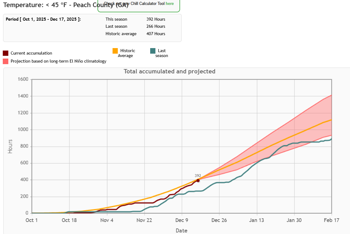
Because of the cooler weather, chill hour accumulation this year has been much faster than last year and could mean that fruit trees will reach adequate chill hours fairly early in the spring. That could make them vulnerable to a late frost if we go through a period of warm weather that causes the fruit trees to break dormancy and then a frost occurs (even if it is not unusually late). This has occurred several times in the last decade so is a cause for concern, but it is too early to know what might happen. Producers in Florida and Georgia can monitor chill hours at http://agroclimate.org/tools/chill-hours-calculator/. The warm and dry conditions are also likely to expand drought across the region according to the CPC.