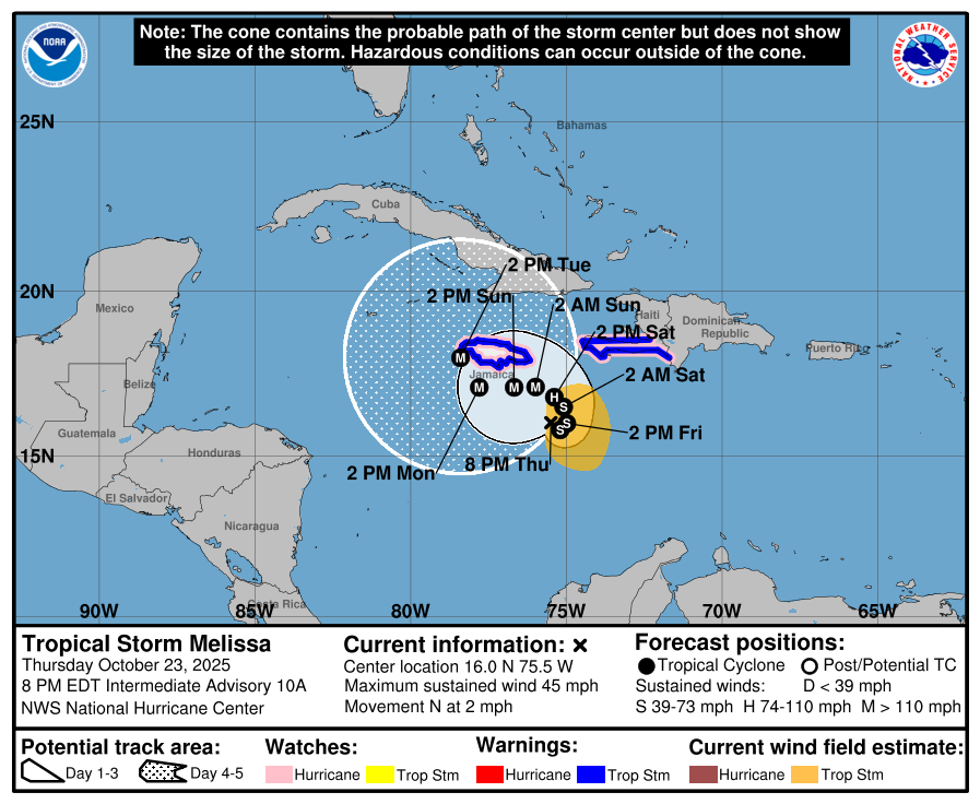
In the last week, we have been following the progression of a tropical wave off of Africa that has turned into Tropical Storm Melissa over the last day. This could be one of the last tropical waves we see this year as the focus of development for tropical storms late in the season usually comes back to the Caribbean and Gulf. Melissa is entering an area of extremely warm water and almost no steering currents in the Caribbean, which means it has the potential to become a very slow-moving major storm as it spins over the warm water and drifts north over time. If the current forecast holds, this has the potential to drop feet of rain over Jamaica, which would cause tremendous damage and loss of life from the flooding that would come with the rain. If the storm moves farther to the east, it will bring heavy rain instead to eastern Cuba and Haiti, causing similar devastation there, especially because of the impact of the air rising over the mountains, adding orographic rain to the total. You can read more in https://www.scientificamerican.com/article/hurricane-melissa-could-drop-two-feet-of-rain-on-jamaica/.
For us in the Southeast, I don’t expect any impacts since every single model run has the storm eventually taking a right turn and moving north and then northeast well before it gets close to the East Coast, although there are a couple of runs that bring it a little closer to the coast than some folk might like. Our concern is for those in Jamaica, Cuba, Haiti, and eventually the Bahamas as it moves north, who may experience a record-setting storm with very strong winds that could last for days over some locations. The damage is likely to be incredible.