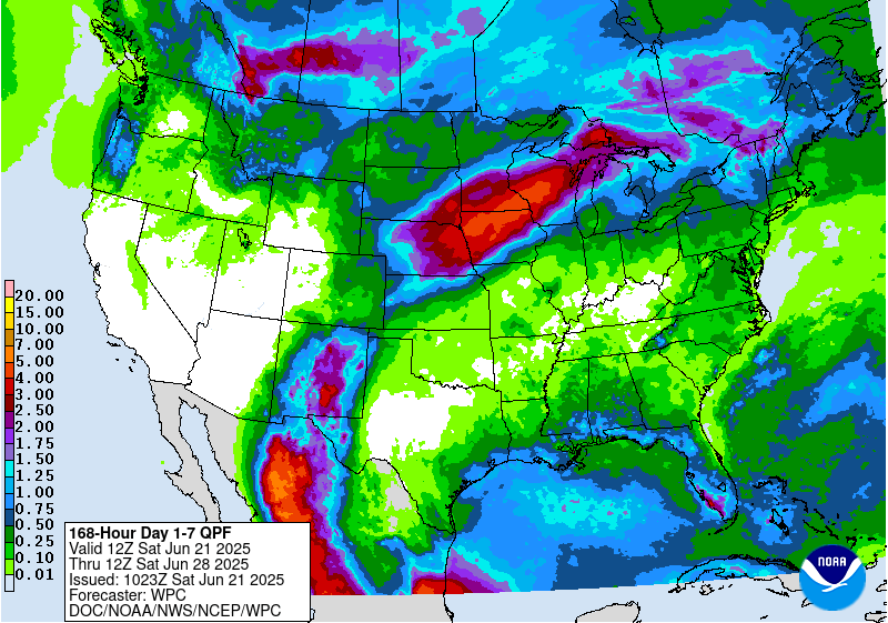
We have been in a fairly wet pattern for the last few weeks, although with hit or miss convective rain a few spots always get hit hard while others get missed. This pattern is shifting this weekend to one where a dome of high pressure is located across the eastern United States extending down into most of the Southeast except Florida. This high pressure is going to be associated with limited development of showers and very hot air, which will put many communities into the heat danger zone. There will be some widely scattered showers, especially toward the end of the week, but most will be short and small so many places will get missed. The wettest areas will be in Florida and along the Northern Gulf Coast and into Alabama, where the clockwise flow around the high pressure center will bring very humid air into the region from the Gulf of Mexico, triggering more showers.
If you are going to be out and about, make sure you are protected from the harsh sun and drink plenty of water and seek shade often to keep yourself safe from heat illnesses. If you are running organized outdoor activities like camps, you will need to be especially cautious about the hot conditions. This is especially true because it is the first really hot spell of the year and many of us are not yet acclimatized to the heat.