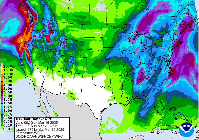
The latest 7-day QPF map shows that almost all of the rain we get this week will be with the system that is moving through on Saturday night into Sunday morning. After that, cool and dry air should move back into the region for the rest of the week with just some very light amounts occurring later in the week. Week 2 shows a continued likelihood of wetter than normal conditions, but weeks 3 and 4 show drier than usual conditions are more likely for the first two weeks of April. The long-range models are not showing any freezing conditions south of the far NE Georgia mountains through the end of March.