As expected, today NOAA issued a La Niña Advisory, indicating that La Niña conditions have developed and are expected to continue with an 87% chance of La Niña in December 2021- February 2022. We’ve been expecting this for a while, but it takes several months after signs start to appear before one is officially declared. You can read the official announcement here. The Washington Post also has a story today describing what the La Niña means for the US climate for the next few months:
- Extending favorable conditions for Atlantic hurricane activity this fall.
- Worsening drought conditions in the Southwest through the winter and potentially elevating the fire risk through the fall.
- Raising the odds of a cold, stormy winter across the northern tier of the United States and a mild, dry winter across the South.
- Increasing tornado activity in the Plains and South during the spring.
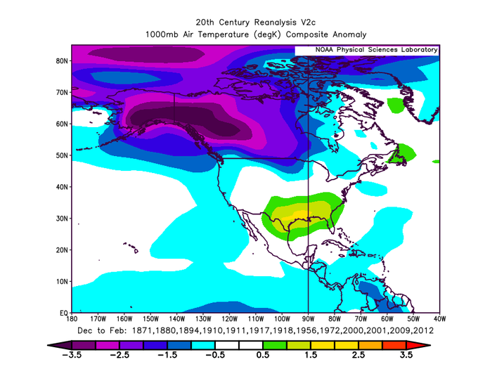
Below is a composite of the temperature anomaly for North America for the second year of a double-dip La Niña from climatologist Brian Brettschneider, showing that if you like cold, Alaska is the place to be this winter. For us in the Southeast, warmer than normal conditions are likely barring an oddball event like the Sudden Stratospheric Warming last year.
If you’d like to see how the precipitation pattern changes depending on whether we are in a La Niña or El Niño, Jan Null has provided a comparison for the last 20 years to show how winter precipitation varied with each year at https://ggweather.com/enso/october/. We are predicted to be in a weak to moderate La Niña.