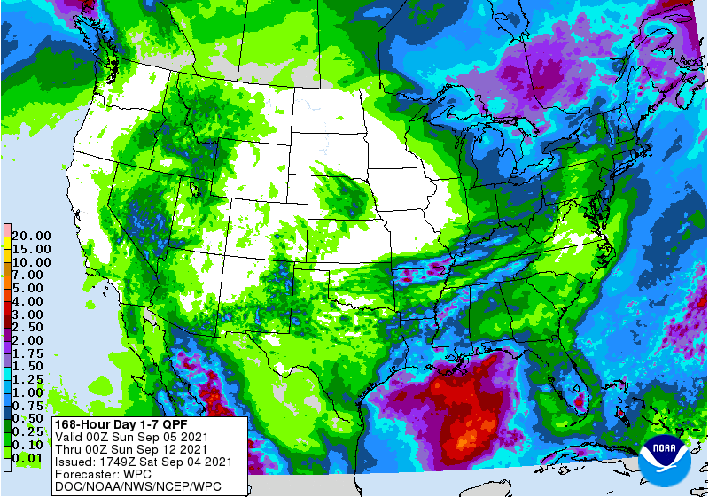
The latest 7-day QPF map shows relatively light rainfall across most of the Southeast this week. The highest rainfall amounts will be in southern Florida and northwestern Alabama. But there is a big mass of disorganized convection in the Caribbean that could form a tropical depression within 5 days, and that has the potential to bring some rain to the Southeast after that. Models are not good at identifying the movement of a storm when it hasn’t even formed yet, but a few of the preliminary model runs put the storm over the Southeast (some also put it over Texas, just to show there is not much consistency yet). Something to watch. Meanwhile, Larry has become a major hurricane over the Atlantic but is already starting to move north and is not expected to affect the Southeast other than some big waves along the East Coast. More waves coming off of Africa mean that the season should become more active again in the next couple of weeks.