After a couple of hot days, the beginning of August is expected to be cooler and wetter than normal, especially across the southern half of Georgia, as a nearly stationary front is expected to sit over the area for a lot of the week. This means lower temperatures, especially during the day, less solar radiation, and higher humidity. Those conditions will lead to increases in pressure on crops by fungal diseases, especially once we return to higher temperatures in the second week. The rest of the month is expected to continue to be wetter than normal, although the rain will be spotty as summer rains often are. Temperatures will continue to be mild although after the first week they will stay close to normal and we may some periods of hot weather as well. Climatologists don’t see any big changes in the weather patterns for the next couple of months, so I continue to expect wetter than normal conditions and seasonal temperatures for most of the rest of the growing season.
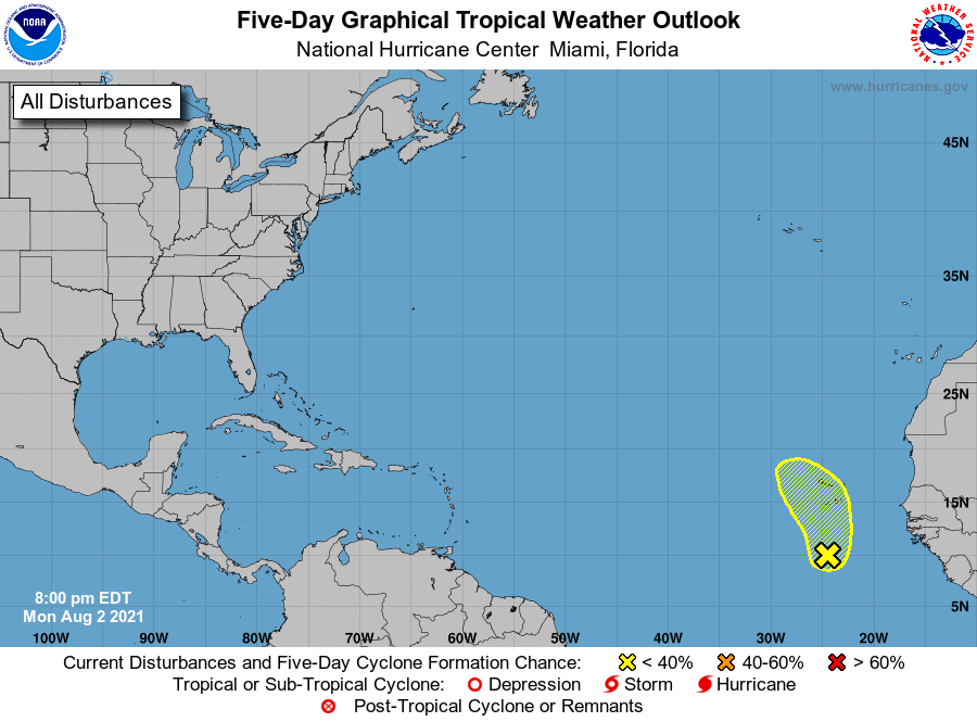
The tropics have been fairly quiet for the last month since the early flurry of storms. This is typical for July and early August, compared to last year which was not typical at all. The long-range models are starting to show storms developing in the Main Development Area of the Atlantic Ocean as dust off of Africa decreases and the waves coming west off of Africa become stronger and more frequent. You can see the first sign of this in the 5-day tropical outlook, although I don’t think the current wave coming off of Africa is going to develop much because it is still under the influence of a lot of dust. The next wave looks a little more promising but is a long ways off. The main tropical development period is August 15 through October 15, although storms can certainly occur after that. The forecasts for the season continue to be for more named storms than usual, so once the season gets going again, we can expect to see a fair amount of activity. Of course, we don’t know where those storms will go, so they may or may not affect producers this year.
We are currently in a La Niña watch. That means that even though we are currently in neutral conditions, we are expected to go back into a La Niña by late fall. This means that the late fall and winter are likely to be warmer and drier than usual, especially in southern Georgia and Alabama and northern Florida. Even though that is statistically the most likely climate for a La Niña winter, last year was an exception due to the occurrence of a Sudden Stratospheric Warming (SSW) event which drove cold air down through the central US in February. We don’t often get SSW events two years in a row, so the statistics say that warmer and drier this winter is still the best bet. We often get droughts in the summer after a La Niña, but not always, as this year can attest.