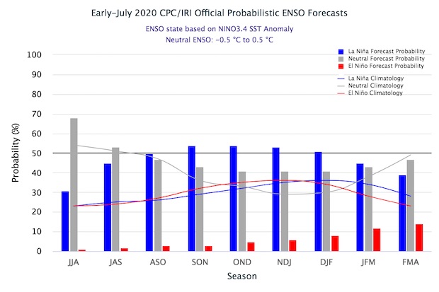
If you’ve been following conditions in the Eastern Pacific Ocean lately, you know that the temperatures there have been showing the characteristic pattern of colder than normal temperatures along the equator. This is the signature sign of a La Nina. While a La Nina is not officially called until the conditions have lasted for 4 months, today NOAA put us in a La Nina watch. This indicates that they think the current pattern is likely to continue and strengthen over the next few months, leading to a La Nina by fall. The current prediction is for the La Nina conditions to continue through mid-winter before returning to neutral conditions. Neutral conditions in fall and winter favor more tropical storms during the Atlantic tropical season and drier and warmer than usual weather in late fall and in winter across the Southeast but especially in Florida, southern Georgia and Alabama. You can read more at https://www.climate.gov/news-features/blogs/enso/july-2020-enso-update-la-ni%C3%B1a-watch