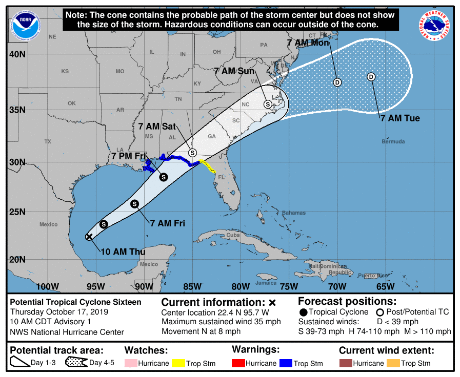
Another tropical disturbance is headed towards Georgia. This storm, which is likely to become TS Nestor in the next day, is predicted to develop in the western Gulf of Mexico and move towards the northeast. Some high clouds from the storm are already visible on satellite over SW Georgia. At this time the forecast models put it across central or southeast Georgia on Saturday. It will bring some heavy rain to areas that got hit with rain earlier this week, which could lead to some local flooding. Quite a change from the very dry conditions that have been occurring and are shown on the Drought Monitor released this morning (its cutoff was Tuesday morning, before most of the rain occurred).
At this time, there is no expectation that possible TS Nestor will develop into a strong hurricane (although it has a small chance of reaching minimal hurricane strength before landfall due to the warm Gulf water), so it won’t produce Michael-like damage. But it will still produce gusty winds and locally heavy rains and perhaps some small tornadoes, especially to the right of the path of the center of circulation. Southeast Georgia is the most likely to be affected, although the actual impacts will depend on the exact path the storm takes. Northwest Georgia is the least likely to be affected, and could see no rain at all or perhaps some light rain, especially later in the weekend as the storm moves off to the northeast. Central Georgia could see the strongest winds if the currently projected path is where the storm actually goes.
If you have outdoor activities or events planned for Saturday, especially if you are in the southern half of the state, be prepared for windy conditions and heavy rain. Isolated power outages and blocked roads could occur where the ground is saturated from the rain earlier this week and where strong winds occur as trees may blow over.
Areas along the Gulf coast should watch for potential storm surge and high waves and rip currents as the storm approaches.