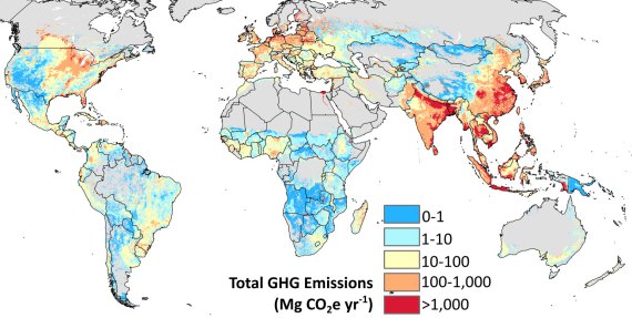
The University of Minnesota Institute on the Environment issued a new map showing global emissions of greenhouse gases such as carbon dioxide and methane due to crop and food production this week. According to the map, much of the inland Southeast is relatively low in GHG emissions. Florida and the coastal plains, however, put off more emissions due to the intensive agriculture going on there, including draining of wetlands and use of fertilizers. You can read more about it and view a larger map at https://environment.umn.edu/news/umn-led-study-provides-first-global-picture-greenhouse-gas-emissions-crop-production/.