This morning NOAA published their latest outlooks for the upcoming fall and winter climate. Maps are shown below. You can also get them at https://www.cpc.ncep.noaa.gov/products/predictions/long_range/seasonal.php?lead=1.
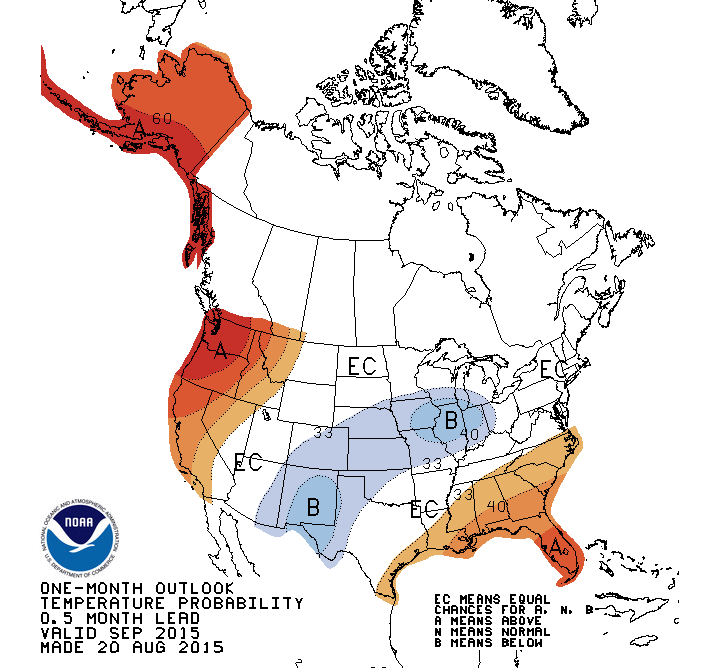
The outlook for September shows that Florida and southern Georgia and Alabama have the best chance of above normal temperatures and below normal precipitation, while other areas don’t have a strong signal towards warmer, colder, wetter or drier.

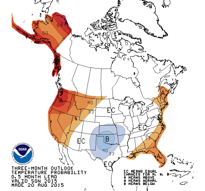
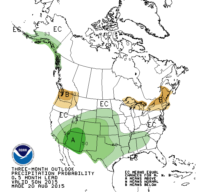
The outlook for September through November shows an increased chance of above normal temperatures in the same area as the September map. There is no strong signal for precipitation this fall, although the areas farthest from the coast show a slightly increased chance of wet conditions.
The outlook for December through February shows a classic El Nino pattern, with cool and wet conditions expected to occur across much of the Southeast, which warm and dry conditions are likely in northern states.


Outlooks for next spring and summer have little skill and are not shown here, although there is a slight increase of chances of above normal temperatures based on long-term temperature trends.