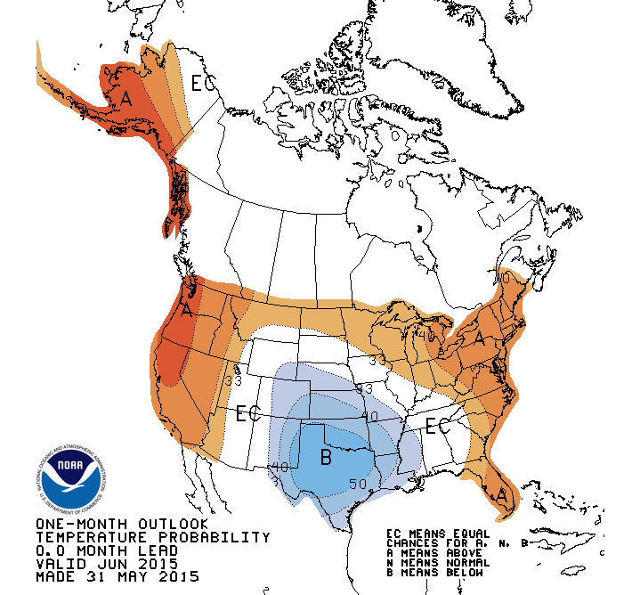
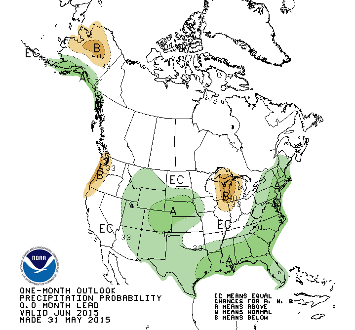
For meteorologists, June 1 through August 31 is considered summer. NOAA’s Climate Prediction Center released an updated outlook for June that shows a continuing increased chance of wetter than normal conditions for the month. Temperatures are expected to be above normal for the first half of the month but the average for the entire 30 days is less certain.
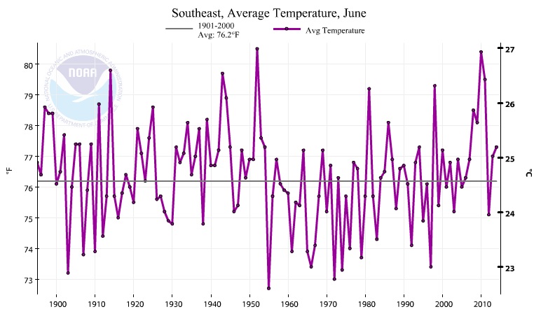
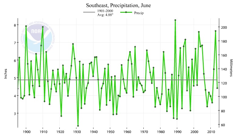
The trends in temperature and precipitation for the Southeast for June are shown below, courtesy of the ‘Climate at a Glance’ tool from NCEI. Since the 1970s, temperatures in the Southeast as a whole have risen, although there is a lot of year to year variability in the values. There has been little trend in the long-term rainfall values for June in the Southeast. Notable in the two graphs are the consecutive years of above normal temperature and low precipitation from 2006 to 2011 which encompass two significant droughts which hit part of the Southeast during those years. In the entire record from 1895 to 2014 there is no other set of years that has such a long string of such below-normal precipitation, although the late 1970s into early 1980s was similar. You can see how your state compares at https://www.ncdc.noaa.gov/cag.