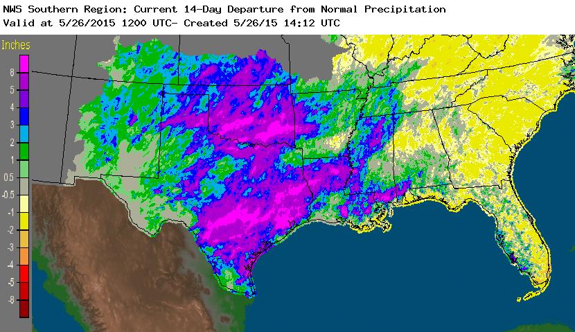
You may have read the news about the extreme flooding that is occurring over the central part of the United States. In Sunday’s post on climate data sources I showed a precipitation map from the Oklahoma mesonet; some stations reported more than 20 inches in the last 30 days! You can read one story about the flooding at EarthSky here. A map from the NWS is shown below with rainfall departures for the last 14 days (you can get updates at https://water.weather.gov/precip/).
What would you do if faced with extreme precipitation? There is an observed trend towards more extreme precipitation events in the United States, so you are likely to face this situation at some point in the future. Preparation is key to being able to respond quickly and effectively to the event. AgWeb posted a link to an article from Nationwide Agribusiness with specific tips for agricultural producers here. The best thing you can do to protect your business is to have an emergency plan in place before the event occurs. You can get help in putting a plan together at https://www.ready.gov/business. The North Carolina Department of Agriculture also has a good template here and Iowa State has one here.