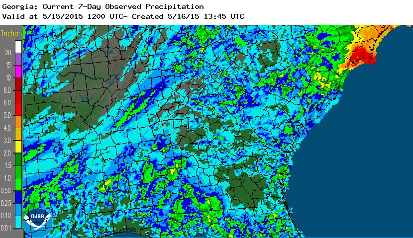
In the last seven days, rainfall across the Southeast has been pretty spotty except where Tropical Storm Ana traveled. The radar-estimated precipitation is shown below. Most areas received well less than an inch for the week. At my own house I received no rain, although the radar estimated that I got a little. Most likely any that fell did not reach the ground but evaporated as it fell.
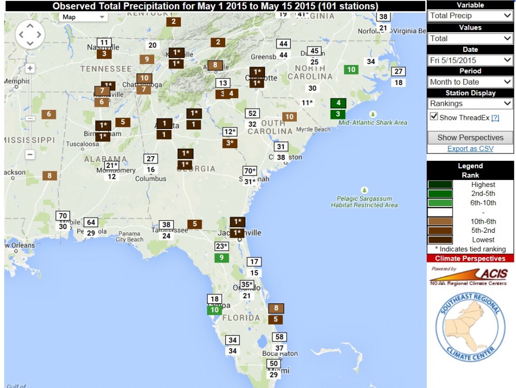
The SERCC Perspectives tool shows that many areas of the Southeast had or tied their driest May to date through yesterday. In Athens we have received no rain for the month; the only other year with no rain through May 16 was 1913. In Atlanta they have received only a trace so far this month. The next driest year, with 0.01 inches through the 15th, was 1932.
What does the next week hold? The 7-day QPF forecast shows that rainfall across most of the Southeast is expected to be less than an inch, which is below normal again. If this forecast verifies, then it would not surprise me to see D0 (abnormally dry) conditions expand across the region in this coming Thursday’s Drought Monitor map. Since corn is now starting to tassel in some parts of the region, it needs at least 0.3 inches per day to stay healthy, and will need irrigation to meet its water demands.
