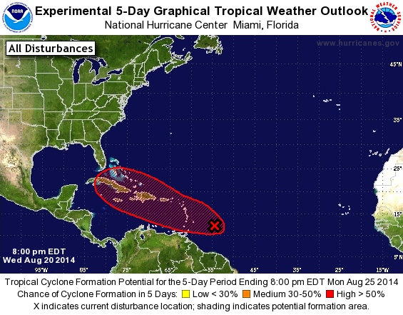
The tropics are starting to heat up, as we expect to happen in late August and on into September. This is the peak time for tropical storm development in the Atlantic. Right now there is a broad area of rotating low pressure in the Atlantic Ocean to the east of Venezuela moving towards the west. The National Hurricane Center gives this tropical wave a better than 50 percent chance of developing into a tropical cyclone within 5 days. This would become TS Cristobal if it reached tropical storm force. The blogosphere has gone wild with amateur meteorologists using single unrealistic computer models to predict a major hurricane in the Gulf of Mexico in the next ten days. However, most responsible atmospheric scientists are far more skeptical of what the future prognosis of this storm is. Other more reliable models show little development into a strong storm, and the predicted paths of the storm are all over the place. Certainly the continued evolution of the storm is something we need to watch in the Southeast, but it may take several days or even more to have a good understanding of how strong this storm may become and where it will go. If it does affect us, it should be at least a week before we see any impacts. Stay tuned to weather forecasts and this blog for updates.