Tropical weather
-
With the recent increase in hurricane activity in the Atlantic, you may be seeing pictures of the National Hurricane Center’s forecast cones for upcoming storms. There is a lot of misinformation about what the cone means and what it does not mean. NOAA provided this short video that explains how the cone is drawn and…
-
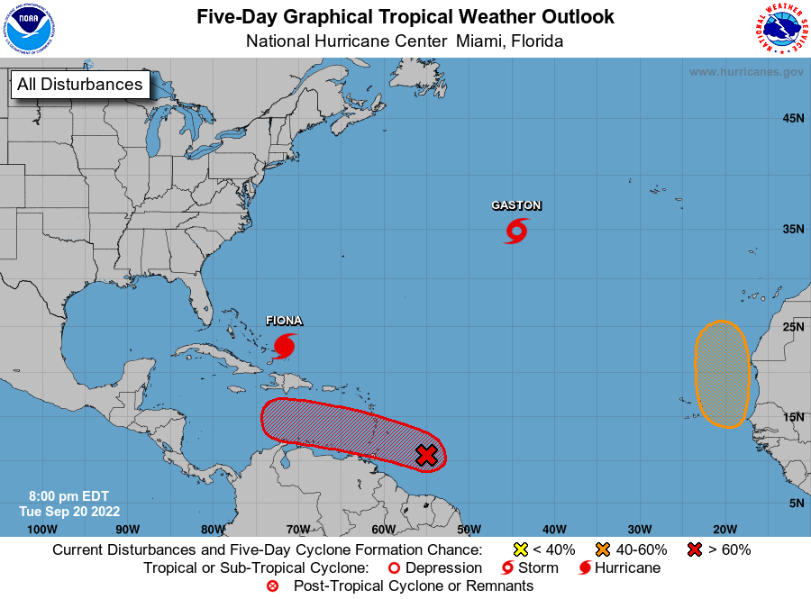
While the early part of this year’s Atlantic tropical season was very quiet, lately things have gotten a lot more active. Fortunately, the recent storms so far have kept well away from the Southeast as a strong high pressure center has diverted the storms away from us. This may be about to change with a…
-
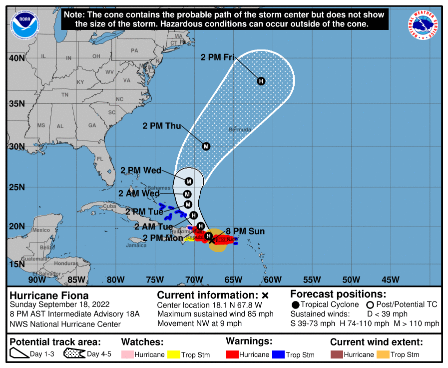
For the last week, we have been watching the development of Tropical Storm Fiona as it moved towards the Southeast from the eastern side of the Atlantic Ocean. Today, Fiona became a hurricane just shortly before it made landfall near the southwestern tip of Puerto Rico. Impacts from Fiona on PR have been tremendous, and…
-
You may be wondering why this year’s hurricane season so far has been so quiet. I think that an unfavorable atmosphere dominated by a lot of dust off of Africa has tamped things down so far, although that may be ending. Here is a good description of other quiet hurricane seasons from Weather.com. Even though…
-
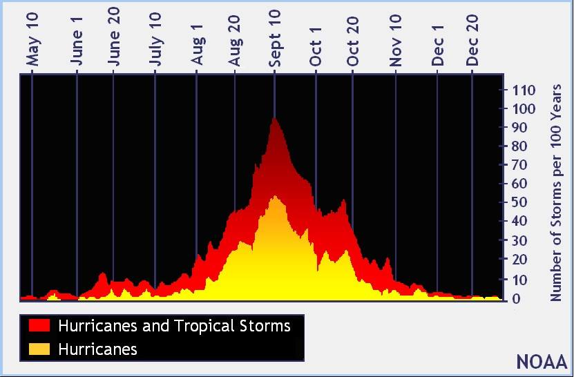
If you know something about hurricane climatology, you probably already know that the peak of hurricane season is in early to mid-September based on the likelihood of a named storm occurring on any particular date. But it turns out that there are different ways to determine it based on counts, tropical storm energy, and other…
-

Here’s an interesting long-form story from CNN for those of you who, like me, are fascinated by the work that hurricane hunters do to monitor developing storms and collect information that can be used to predict future storm path and development. In this case, the hurricane hunters are taking measurements near the Cape Verde Islands…
-
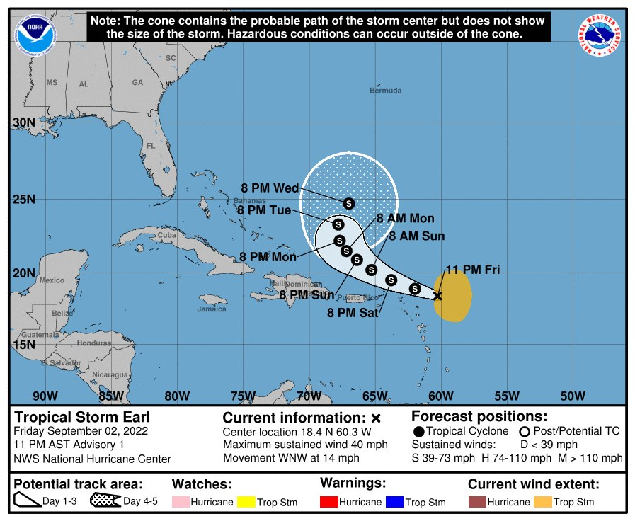
As of 11 pm on Friday night, Tropical Storm Earl formed in the western Atlantic Ocean. The current forecast is for Earl to curve to the north and then northeast without hitting any land. It is not expected to become a hurricane but to remain a tropical storm. Folks along the East Coast might want…