Tropical weather
-
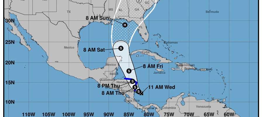
A new tropical depression has formed off the coast of Nicaragua and is expected to move north and strengthen over the next few days. Once it reaches tropical storm status, it will be called Nate. Models of the storm’s path indicate a high probability that it will move over parts of the Southeast by this…
Posted in: Tropical weather -
AgWeb posted an article from the Associated Press this past week describing just some of the heartbreaking losses that Puerto Rican farmers are experiencing from Hurricane Maria. Impacts are both from the storm itself and from the aftermath with the continuing loss of power, which is a major problem for the significant dairy industry on the…
-
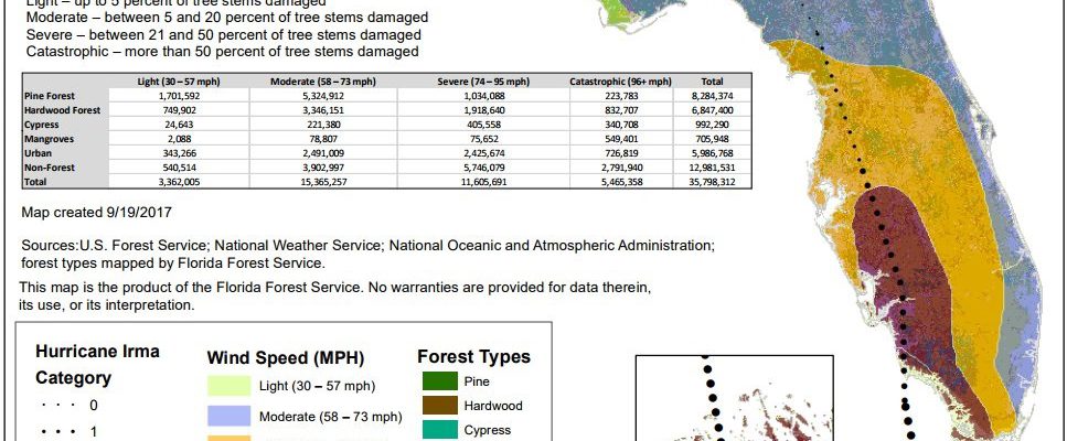
Here’s an astounding fact on timber losses in Florida due to Hurricane Irma from David Zierden on Twitter, passed on from the Florida Forest Service: the amount totalled $1.633Billion, equal to about five of Florida’s annual timber harvests. I have not seen similar loss estimates for Georgia or South Carolina so far.
-

Weather Underground posted a story about the effects of the heavy rain on the water level of Lake Okeechobee today. It describes how rain from Hurricane Irma brought the water level up to over 16 feet above sea level. They can only remove about a quarter inch of water from the lake every day through…
-
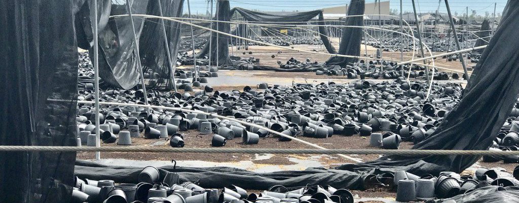
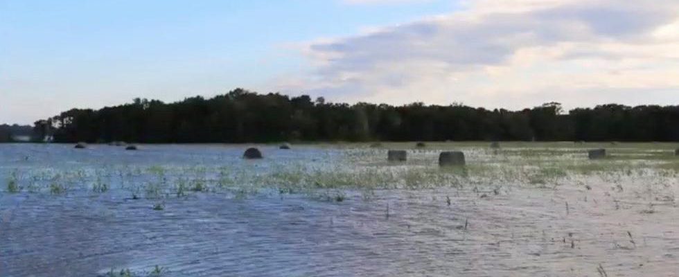
Vegetable Growers News reported this week that many vegetable growers in Florida were not insured and will face significant losses from Hurricane Irma, including plants that were already in the ground as well as plastic sheeting used to prepare strawberry fields for the upcoming season. USDA reported in a study earlier this year that only…
-
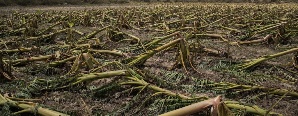
The Weather Channel posted a set of photos taken of farm destruction from Hurricanes Harvey in Texas and Irma in Florida and the Southeast. Not many photos have made it out of Puerto Rico yet but the few I have seen show almost total devastation of the crops there from Hurricane Maria, along with the…
-
The National Weather Service offices in Atlanta GA and Charleston SC have published short reports on the impacts of Hurricane Irma on their forecast areas. You can read the Charleston one at https://www.weather.gov/chs/TropicalStormIrma-Sep2017 and the Atlanta one at https://www.weather.gov/ffc/2017_Irma.
Posted in: Tropical weather